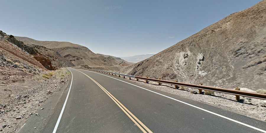
A tough desert road to Towne Pass in CA
Towne Pass is a high mountain pass at an elevation of 1.515m (4,970ft) above the sea level, located in Inyo County, in the U.S. state of California.
Is Towne Pass in California paved?
Tucked away on the west side of Death Valley National Park, the road to the summit is totally paved. It’s called CA-190 (State Route 190). The road connects the Panamint Valley and Stovepipe Wells and offers incredible views along the way.
Is the road to Towne Pass in California dangerous?
Located in the eastern central part of California, the windy road is not easy, with countless turns and twists. Ideal time to travel is daylight. Not advised night drive. The drive is steep, hitting a 15% of maximum gradient through some of the ramps. Drive at moderate speed. You’re not on a race. The current speed limit on this section is 55 miles per hour, but drivers are advised to slow to 30 miles per hour to drive safely through a series of curves, the tightest of which has a radius of 350 feet. There are plans to realign a section of CA-190 immediately east of Towne Pass to improve safety and reduce collisions.