Dosewallips River Road in Washington Hasn’t Seen a Car Since 2002
Dosewallips River Road (NF-2610 Road) is a former forest road located in Jefferson County, in the US state of Washington, that once led into Olympic National Park. In 2002, a major washout blocked vehicle access, and the road has remained partially closed since.
How long is Dosewallips Road?
The road is about 8.6 miles (13.84 kilometers) long. It begins at US-101 near Brinnon and follows the Dosewallips River into the park. It was originally used to access campgrounds and trailheads in the backcountry.
Is Dosewallips Road paved?
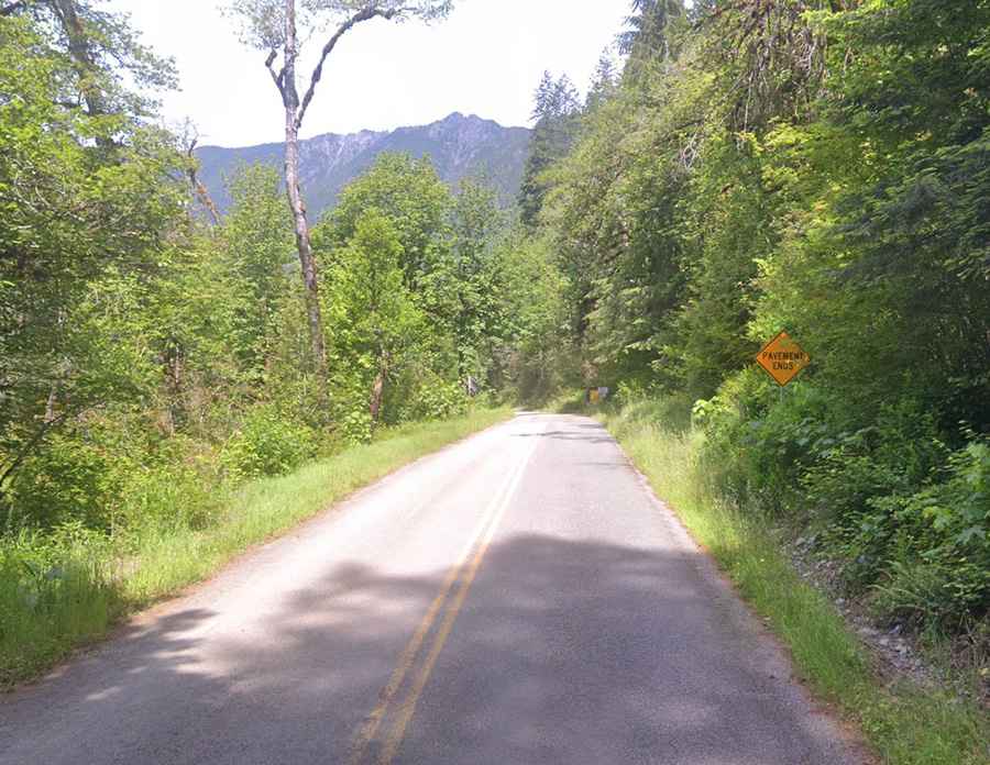
The road is paved for the first miles and then becomes gravel for the last 2 miles before the washout. The paved section is in fair condition. The unpaved part is rough but passable in dry conditions.
When was Dosewallips Road blocked?
A washout in January 2002 destroyed a 300-foot section of the road. A hillside collapsed into the river, taking the road with it. Vehicle access has not been restored since.
Can you still reach Dosewallips Campground?
Yes, but only on foot, by bike, or horseback. There’s a small parking area near the washout, and visitors continue along the road on foot to reach the campground.
What is Dosewallips Road like today?
The road is still usable as a trail. It's blocked by large rocks at the washout. Past that point, the route continues as a path through forest and along the river, leading to several trailheads inside the park.
Is Dosewallips Road open year-round?
The road is open to non-motorized use all year, but winter conditions can make access difficult. Snow, downed trees, or flooding may block parts of the trail.
Why hasn’t Dosewallips Road been repaired?
The area lies inside Olympic National Park, where major road work is restricted. Rebuilding the road would be expensive and environmentally disruptive. For those reasons, it has been left in its current state.
What makes Dosewallips Road interesting?
Dosewallips Road shows how nature can reclaim a man-made route. It still provides access to waterfalls, remote campsites, and trails, but only for those willing to go without a car. Its isolation is part of its appeal.