The road to Ben Harrison Peak in OR isn’t an easy one
Ben Harrison Peak is a high mountain peak at an elevation of 2.348m (7,703ft) above the sea level, located in Grant County, in the U.S. state of Oregon.
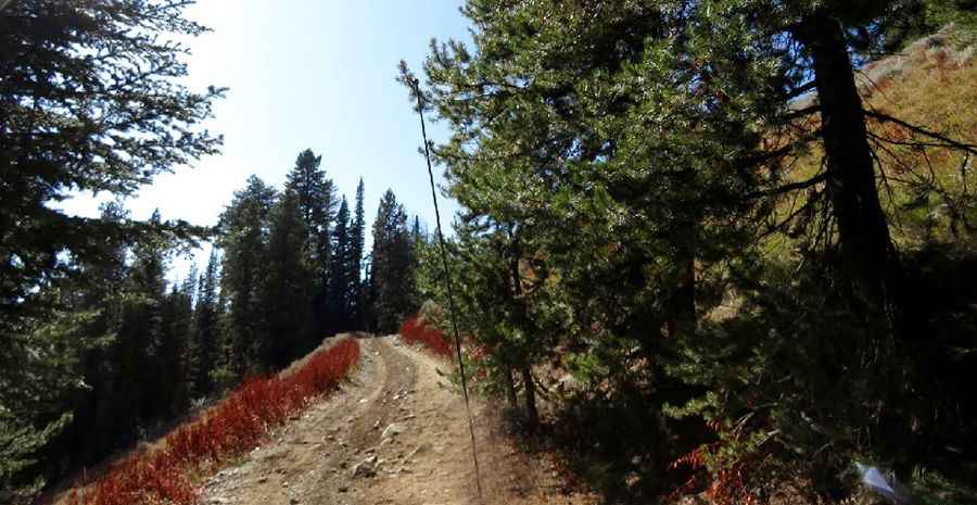
Set high in the western part of the Greenhorn Mountains within the Umatilla National Forest, the road to the summit is totally unpaved with numerous ruts and rocks in the road. It’s called NF-148. A 4x4 vehicle is required. The road is usually passable from Mid-June to October. The road to the summit is very steep, hitting a 13% of maximum gradient through some of the ramps. Starting at Forest Service Road 2010 (Vincent Creek Road), the ascent is 2.57km (1.6 miles) long. The range is the location of many mining sites.
Pic: Barbara Morehead