Road trip guide: Conquering the Boehmer Reservoir in Colorado
Boehmer Reservoir is a high mountain reservoir at an elevation of 3.610m (11,843ft) above sea level, located in the U.S. state of Colorado.
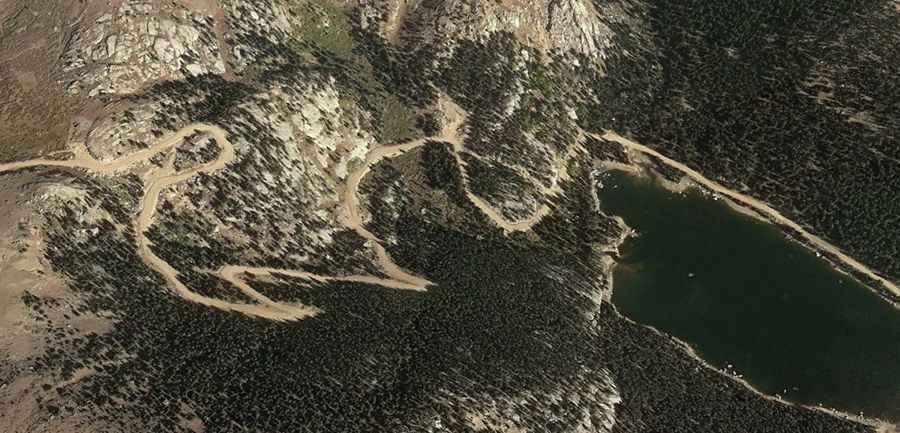
Where is Boehmer Reservoir?
The reservoir, built in 1894, is located west of Colorado Springs, on the boundary between Teller and El Paso counties, in the central part of Colorado, within the Pike National Forest.
Is the road to Boehmer Reservoir unpaved?
The road to the reservoir is a rough dirt road and a high clearance vehicle is required.
How long is the road to Boehmer Reservoir?
The road to the reservoir is 7.24km (4.5 miles) long, starting from Forest Service Road 376. The drive allows visitors to enjoy the solitude and beautiful views all around.
Is the road to Boehmer Reservoir open year-round?
Set high in the Front Range, south of the iconic Pikes Peak the road is not plowed in winters. Accessibility is largely limited to the summer season (usually from Memorial Day to October 1st).
How to drive the unpaved road to Big Horn Reservoir in Colorado?
North of the reservoir, an unpaved road climbs up to Big Horn, a high mountain reservoir at an elevation of 3.727m (12,227ft) above sea level.