How to Get to Dunderberg Peak by Car on Kavanaugh Ridge in California?
Dunderberg Peak is a high mountain peak at an elevation of 3,347m (10,980ft) above sea level, located in Mono County, in the US state of California. It’s one of the highest roads in California.
Where is Dunderberg Peak?
The peak, part of the Kavanaugh Ridge, is located northwest of Mono City, in the east-central portion of California, within the Humboldt-Toiyabe National Forest.
Is the Road to Dunderberg Peak on Kavanaugh Ridge Unpaved?
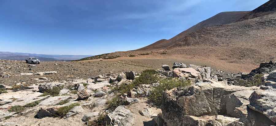
The road to the summit is totally unpaved. It’s a rocky trail, narrow in places, windy, and exposed. It’s suitable for most stock 4x4 SUVs with decent ground clearance.
Is the Road to Dunderberg Peak on Kavanaugh Ridge Open in Winter?
Set high in the eastern part of the Sierra Nevada range, the road tops out at Dunderberg Peak and is usually impassable in winters.
Is the Road to Dunderberg Peak on Kavanaugh Ridge Worth the Drive?
This ridge offers an incredible view of Green Lake, East Lake, and West Lake. There is a little lake not far from the top. The trail follows numerous remnants of California's mining heritage.
How Long is the Road to Dunderberg Peak on Kavanaugh Ridge?
The drive is pretty steep. Starting from FS-32178, the ascent is 5km (3.10 miles) long. Over this distance, the elevation gain is 487 meters. The average gradient is 9.74%.
Pic: James Hatton