How to drive the wild road to Almagre Mountain in Colorado?
Almagre Mountain is a high mountain peak at an elevation of 3.774m (12,381ft) above sea level, located in Teller County, in the U.S. state of Colorado. It’s one of the highest roads of Colorado.
Where is Almagre Mountain?
The peak is located west of Colorado Springs, in the central part of Colorado, within the Pike National Forest.
Why is there a road to Almagre Mountain?
The summit is crowned with a communication antenna and the views from the top are incredible. It provides outstanding views of the Sangre de Cristo and even the Sawatch.
Is the road to Almagre Mountain unpaved?
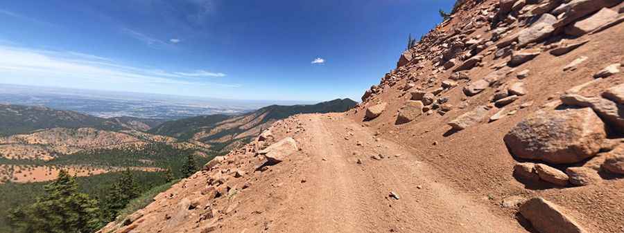
The road to the summit is totally unpaved. It’s called Forest Service Road 379. Looks to be an old wagon trail. It’s not well maintained; there are lots of rocks, ruts, and washed out sections. The final part of the road is blocked by a gate.
Can I drive my vehicle on the road to Almagre Mountain?
The road can be driven by a capable 4WD vehicle.
How long is the road to Almagre Mountain?
The drive is pretty steep. Starting from Forest Service Road 376, the ascent is 12km (7.45 miles) long. Over this distance the elevation gain is 486 meters. The average gradient is 4.05%.
Is the road to Almagre Mountain open year-round?
Set high in the Front Range of the Rocky Mountains, the road is not plowed, and usually impassable from October through June.
Pic: Kyle Santa-Romana