How to drive the 4x4 road to Almagre Mountain South in Colorado?
Almagre Mountain South is a high-altitude peak at an elevation of 3,771m (12,372ft) above sea level, located in Teller County, Colorado. Logistically, the summit is reached via the Forest Service Road 379, also known as Mt. Baldy. Technically, this is one of the highest vehicular routes in the state, requiring a high-clearance 4x4 vehicle to navigate a surface that remains largely unmaintained and exposed to severe alpine erosion.
| Road facts: Almagre Mountain South | |
|---|---|
| Location | Teller County, Colorado (USA) |
| Elevation | 3,771 m (12,372 ft) |
| Length | 10.50 km (6.52 miles) |
| Surface | Unpaved (Rocks, ruts, washouts) |
What is the technical difficulty of Forest Service Road 379?
The ascent to Almagre Mountain South starts from Forest Service Road 376 and spans 10.50 km. Technically, the road follows an old wagon trail profile with an average gradient of 4.60%, but this figure is deceptive; several sections feature much steeper ramps where the 483-meter elevation gain is concentrated. The track is in poor condition, characterized by deep ruts, large loose rocks, and significant washed-out sections caused by snowmelt. Drivers must maintain precise line selection to avoid underbody damage, making a capable 4WD vehicle mandatory for this transit.
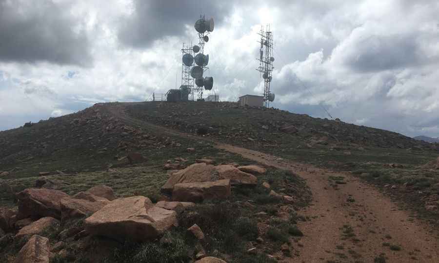
What are the safety hazards of driving at 3,771m in Colorado?
Operating a vehicle at nearly 3,800 meters places Almagre Mountain South among the highest mountain roads in Colorado. Technically, the reduced atmospheric pressure impacts engine torque and cooling efficiency. The summit area is crowned with communication towers and is often subject to rapid weather shifts, including lightning strikes and sudden snow squalls even in summer. Logistically, the final part of the road is blocked by a gate, requiring drivers to plan for a turnaround maneuver on narrow, unpaved terrain. The exposure increases toward the top, where the track lacks any form of shoulder protection or safety barriers.
How to manage the mechanical logistics of the Mt. Baldy descent?
The descent from the summit of Mt. Baldy requires a technical focus on traction and suspension articulation. The "old wagon trail" nature of the FS 379 means the roadbed is unstable; technically, constant vibration can loosen mechanical fasteners and stress the vehicle’s shock absorbers. A low-range gear should be engaged to control the descent on the rockier sections, preventing brake overheating and tire slip on loose scree. Given the isolation west of Colorado Springs, safety protocols mandate carrying recovery gear and ensuring the vehicle's tires have reinforced sidewalls to withstand the sharp granite typical of this sector of the Sangre de Cristo and Sawatch range views.
Pic: Stephen Stacey