How to drive the scenic New Castle-Buford Road in Colorado?
New Castle-Buford Road is a very scenic mountain drive located along Rio Blanco and Garfield counties in the U.S. state of Colorado.
When was the New Castle-Buford Road built?
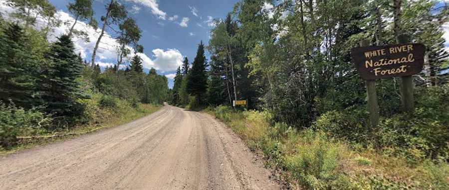
Built between 1926 and 1931, the road is located in the northwestern part of Colorado, within the White River National Forest, across the Flat Tops.
How long is the New Castle-Buford Road?
The Buford-New Castle Road (Forest Road-245) is 69.36 km (43.1 miles) long, running south-north from the Town of New Castle to Buford.
Is the New Castle-Buford Road unpaved?
It’s mostly unpaved and the condition is often good. It is suitable for passenger cars in dry conditions, though it is often heavily washboarded and hasn’t been improved since the 1980s. This is due to the high traffic and weather. Always drive at the speed limit or below. Some residents call the road “one of the most dangerous unimproved roads” in Garfield County.
Is the New Castle-Buford Road worth it?
The road is heavily used during hunting season. It attracts many off-roaders, campers, snowmobilers, and more each year. Remember to drive carefully and stay on the right-hand side of the road, especially when rounding blind corners. It’s said to be one of the most scenic drives in the White River National Forest.
Is the New Castle-Buford Road open in winter?
The road tops out at 3,084 m (10,118 ft) above sea level. It’s closed to wheeled motorized vehicles from November to May. At this elevation, winter comes early and stays late on this trail, so you may only be able to safely run it in the middle of the summer.
Pic: Eric Bassett