The road to Blair Mountain in Colorado is a chillout in high mountains
Blair Mountain is a high mountain pass at an elevation of 3,496m (11,469ft) above sea level, located in Garfield County, in the U.S. state of Colorado.
Where is Blair Mountain?
The road is located in the White River Plateau in the rugged Rocky Mountains, on the northwestern part of Colorado, to the north of Glenwood Springs, spanning Rio Blanco and Garfield counties.
How long is the road through Blair Mountain?
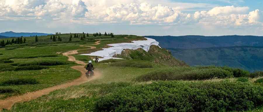
The remote road to the summit is totally unpaved. It’s called Forest Road 601 (aka Blair Mountain Road). It’s very rough, rocky, and steep in places. High clearance, 4-wheel-drive vehicles only. The road is 36.85 km (22.9 miles) long, running east-west from Coffee Pot Road #600 to Forest Road 301.
Is the road to Blair Mountain open in winters?
Set high in the White River National Forest, the entire trail is above 10,000 feet with some parts at 11,000 ft. At this elevation, winter comes early and stays late on this trail, so you may only be able to safely run it in the middle of the summer. The drive gives amazing views of the entire Flat Tops.
Pic: Larry w