Hites Cove Road is one of the gnarliest drives in California
Located in Mariposa County, in the U.S. state of California, Hite Cove is a small mining camp tucked along the Merced River. The road to the town is a nice 4x4 trail with tight turns.
Where is Hites Cove Road?
The trail is located south of El Portal, in the east-central part of California, within the Sierra National Forest. You'll find lots of poison oak here, a few mosquitoes, ticks, and rattlesnakes.
How challenging is Hites Cove Road?
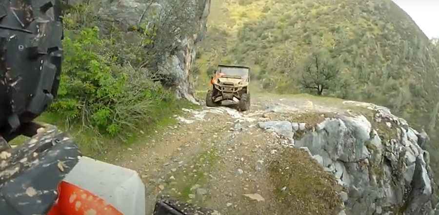
The road to the town is totally unpaved. It’s a maintained fire road. It requires a river crossing to reach the town. The trail is very steep and the rocks are pretty tall. This trail is very hard on brakes if you don't have low gearing or crawl control. The trail is very narrow with dangerous drop-offs: 2 vehicles meeting head-on may result in one driver backing up as much as a half mile to a safe turnout.
How long is Hites Cove Road?
Starting from Jerseydale, the road is 6.11 km (3.8 miles) long. 4WD vehicle required.
Is Hites Cove Road open?
The road is seasonally closed from early November through June and rolls through the narrow canyon of the Merced River. The trail was closed for a few years due to damage from the 2018 Ferguson Fire.
Pic&video: Decathelon Dave