Top 10 Most Dangerous Roads in the USA
The United States’ National Highway System is the most extensive in the world, serving as a critical artery for international commerce and personal transit. However, this complexity comes with significant hazards. According to data from the World Health Organization (WHO) and the NHTSA, the U.S. averages eleven highway casualties per 100,000 residents annually—a rate three times higher than that of the U.K. Understanding the specific topographical and behavioral risks of these ten "lethal corridors" is essential for safe interstate navigation.
| US Highway Safety: Technical Metrics | |
|---|---|
| Deadliest Urban Sector | I-45, Houston (High DUI & Speed frequency) |
| Highest Fatality Volume | US-1, Florida (>1,000 deaths per decade) |
| Technical Difficulty | US-199 (Redwood Hwy) - Narrow twisting lanes |
| Environmental Risk | Hwy 1, California (Landslides & coastal erosion) |
1. I-45 (Houston, Texas)
The I-45 in Houston is consistently ranked as one of the most dangerous urban freeways globally. The high fatality rate is attributed to a combination of extreme traffic density and behavioral factors, including high incidences of texting while driving and alcohol-impaired operation. The lack of controlled speeds in a multi-lane environment creates a volatile driving theater.
2. U.S. Route 1 (Florida)
Stretching 545 miles through 13 counties, Florida’s US-1 is a volume leader in road fatalities. With over 1,000 deaths recorded every ten years, the risk intensifies during peak summer months when tourist traffic merges with high-speed local transit. Its long, monotonous stretches often lead to driver fatigue and lapses in situational awareness.
3. U.S. Route 17 (South Carolina)
While aesthetically captivating, the South Carolina sector of US-17 is a technical trap. Characterized by narrow lanes, blind curves, and frequent wildlife crossings (deer and alligators), it averages one death every two miles. The transition from scenic vistas to sharp, unbanked turns requires constant mechanical vigilance.
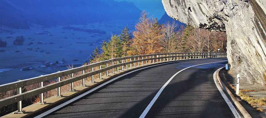
4. U.S. Route 199 (Northern California/Oregon)
Known as the "Redwood Highway," this 80-mile stretch is a high-consequence environment. The road is notoriously narrow and twisting as it carves through ancient forests. The proximity of massive redwoods leaves zero margin for error, resulting in a staggering fatality rate of one death per two miles.
5. U.S. 83 (Texas)
Traversing the central spine of the U.S. from Canada to Mexico, the Texas portion of US-83 is the most lethal. It is characterized by high-speed rural transit where "head-on" collisions are frequent, averaging one fatality every two weeks. The isolation of this route often delays emergency response times.
6. Highway 160 (Colorado)
Colorado's Highway 160 features extreme alpine technicality. Steep gradients and tight switchbacks—specifically through the Wolf Creek Pass—test the thermal limits of braking systems. Sudden shifts in snow and ice conditions make this one of the most seasonally hazardous roads in the interior U.S.
7. I-19 (Arizona)
Connecting Tucson to the Mexican border, the 63-mile I-19 suffers from a high incidence of fatigue-related accidents. The road’s signage (famously in metric) does little to mitigate the danger of "hypnotic driving" across the desert floor, where drowsy drivers frequently drift across lanes at high velocity.
8. I-95 (Miami, Florida)
The Miami sector of the I-95 is a hotspot for high-speed "weaving." The implementation of express lanes has inadvertently increased risk, as drivers often make aggressive, late-lane changes to enter or exit tollways. This behavior, combined with the highest traffic density in the state, results in a saturated collision environment.
9. Highway 1 (California)
The Pacific Coast Highway is a study in geomorphological risk. Beyond the distraction of its majestic views, the road is prone to catastrophic mudslides and coastal erosion. Sudden fog banks and the lack of guardrails in high-exposure cliff sections make it a route that demands absolute focus.
10. Route 1 (Maine)
In the Northeast, Maine’s Route 1 presents a "perfect storm" of logistical hazards. Poor signage combined with tight, slippery curves creates a difficult environment during the long winter months. Furthermore, large-scale moose crossings are a primary cause of high-impact collisions that contribute to its dangerous reputation.
Conclusion: Strategic Awareness for the US Grid
The American highway system is a marvel of engineering, but its safety is entirely dependent on driver preparation and respect for local conditions. Whether it is the moose of Maine or the high-speedweaving of Miami, each road has a unique "threat profile." By understanding these patterns, drivers can actively mitigate their risk and ensure a successful transit through the nation’s most challenging corridors. Coverage across corridor risk profiling and fleet route safety resources consistently notes that carriers reducing exposure in 2025 are combining seasonal route planning, incident-density mapping, and telematics-based hazard alerts — lowering collision risk, improving driver situational awareness, and strengthening safety outcomes across high-risk highway segments.