Olympic Peninsula Loop Drive: Driving the 329-mile US-101 in Washington
The Olympic Peninsula Loop is a long-distance coastal and forest highway covering 329 miles (531 km) through the western sector of Washington State. Running mainly along the paved US-101 highway, the loop circumnavigates the Olympic National Park, forcing drivers to deal with relentless rain deluges, heavy logging truck traffic, and sudden asphalt washouts.
| Road facts: Olympic Peninsula Loop Drive | |
|---|---|
| Location | Olympic Peninsula, Washington State, USA |
| Distance | 329 miles (531 km) loop |
| Major Highways | US-101, US-12, WA-8 |
| Surface | Paved asphalt in varying condition |
| Primary Hazards | Heavy rain, hydroplaning, mudslides, and timber trucks |
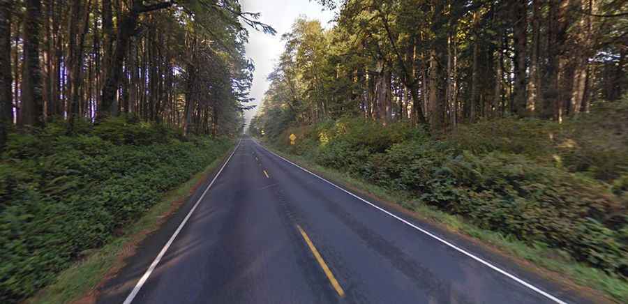
How challenging is the traffic and lanes on the US-101 Olympic Loop?
The 531-kilometer loop runs entirely on paved tarmac, requiring at least 8 hours of non-stop driving time to complete. The main hazard on the route is the presence of massive logging trucks moving commercial timber from the coastal rain forests. The US-101 shrinks down to narrow, winding single lanes along the shoreline, completely lacking wide asphalt shoulders. Sharing these tight bends with heavy-tonnage industrial trucks during low-visibility downpours forces drivers to hold the outer edge of the lane, where the road surface is frequently saturated with water, causing vehicles to hydroplane and lose steering traction.
Why does Pacific Northwest weather damage the Olympic Peninsula asphalt?
The Olympic Peninsula is one of the wettest regions in North America. While summer months from July to September remain relatively dry, the rest of the year is hit by continuous cycles of heavy rain and dense coastal fog. This constant water saturation triggers massive mudslides and rock washouts that collapse sections of the US-101 asphalt into the valley drops without notice. In winter, the higher elevations of the loop are hit by heavy snowstorms, while the sea-level sections face fierce Pacific winds that throw debris and fallen trees directly onto the driving lanes.
What infrastructure and mechanical risks exist through the Hoh Rainforest?
The western sector of the loop cuts straight through dense temperate ecosystems like the Hoh Rainforest. The near-constant humidity creates a slick, mossy organic film over the asphalt lanes that reduces braking efficiency and tire grip. The highway follows steep coastal cliffs where severe water erosion constantly weakens the stability of the road shoulders. Mechanical garages and fuel stations are sparse along the remote western coast of the peninsula, and mobile phone signals disappear completely inside the deep forest canyons, leaving drivers stranded without help if a pothole tears a suspension component or punctures a tire.