The Great River Road Replaces Danger with the Amazing Natural Beauty of the Mississippi River
The Great River Road is one of the most extensive and strategically significant scenic corridors in the United States. Spanning approximately 3,000 miles from the headwaters in Minnesota to the Gulf of Mexico, this road follows the complex hydrology of the Mississippi River. While it lacks the high-altitude hairpin turns of the Rockies, it presents its own set of navigational challenges: narrow river-town transits, significant humidity shifts, and the unique topography of the Driftless Area, where towering bluffs constrain the road to the river's edge.
| Great River Road: Wisconsin Sector Data | |
|---|---|
| Primary Arterial | Wisconsin State Highway 35 |
| Topographical Feature | Mississippi River Bluffs (Limestone escarpments) |
| Technical Profile | Narrow-lane transits & wetland hydrology |
| Total State Length | 250 miles (Wisconsin segment) |
The Wisconsin Corridor: Navigating the Bluffs
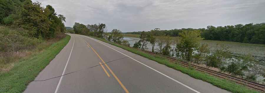
In Wisconsin, the Great River Road utilizes State Highway 35, a well-maintained but technically restricted route. The geography here is defined by "bluffs"—steep limestone cliffs to the east and the vast Mississippi floodplain to the west. In sectors like Alma and Maiden Rock, the road is compressed into a single-lane width between the vertical rock face and the water, demanding high situational awareness from drivers, especially when sharing the route with heavy agricultural machinery.
North to South: Strategic Positioning
For the optimal perspective of the river’s hydrology, the route should be navigated from north to south. This places the vehicle in the lane closest to the riverbank, offering unobstructed views of the Mississippi’s vast expanse.
- Prescott and the St. Croix Junction: The northern terminus in Wisconsin begins where the St. Croix River merges with the Mississippi. This is a critical hydrological node and serves as the primary orientation point for the 250-mile transit.
- The Driftless Topography: Unlike the rest of the Midwest, this region was bypassed by the last glaciation, resulting in deep valleys and rugged hills that dictate a meandering road path.
Technical Sectors: Maiden Rock to Alma
The segment between Maiden Rock and Alma represents the narrowest technical stretch in the state. The Maiden Rock Bluff towers over the asphalt, creating a sense of "cramped" verticality. In Alma, the town’s infrastructure is literally one road wide, forced into a narrow strip by the geography. Beyond the urban nodes, the road crosses the Chippewa River delta, where the terrain transitions into complex wetlands and flood-prone marshes that require vigilant monitoring of local weather patterns.
Historical and Logistical Nodes
The road passes through several significant historical waypoints that reflect the 19th-century westward migration:
- Prairie Du Chien: Located in the far southwestern corner of the state, this is a major historical node featuring Fort Crawford, which documented the logistical challenges of early frontier transit.
- La Crosse: The largest metropolitan node on the Wisconsin segment, providing critical services and a transition from rural secondary roads to higher-density urban infrastructure.
Environmental Variables
The Great River Road is subject to extreme seasonal volatility. In the northern sectors, winter transits involve heavy snow and ice accumulation within the narrow bluff corridors. Conversely, the southern reaches near the Illinois border experience intense summer humidity and "lake-effect" fog from the river, which can reduce visibility during early morning transits.
Conclusion: The Architecture of the River Road
The Great River Road in Wisconsin is a masterclass in adapting infrastructure to complex riverine geography. By following the contours of the Mississippi, Highway 35 offers a unique driving experience that balances technical lane management with deep geographical immersion. Whether navigating the tight transits of Alma or the expansive vistas of the Driftless Area, this road remains a vital link in the American inland transport network.