Dare to drive the dangerous Calico Peak
Calico Peak is a mountain peak at an elevation of 1.385m (4,543ft) above the sea level, located in San Bernardino County, in the southern portion of the U.S. state of California. 4x4 and high clearance is a must. Never attempt alone. You cannot turn around and go back in the most difficult spots.
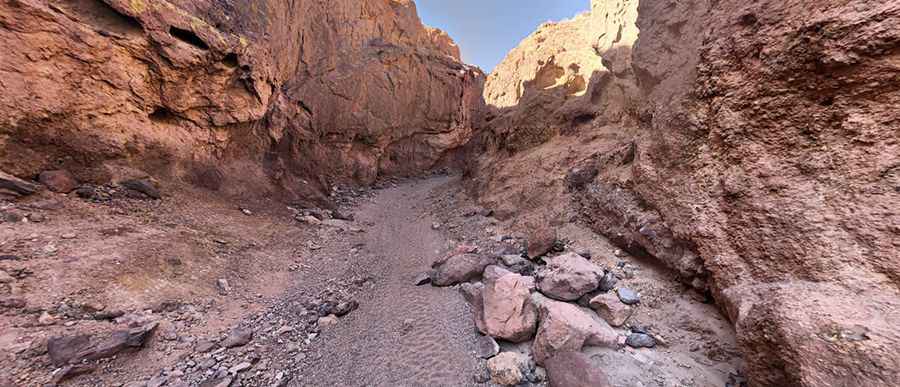
Located in the Calico Mountains Range in the Mojave Desert, the road to the summit is extreme. It’s called Doran Scenic Drive. It was once a paved road and you'll see chunks of old pavement that have added to the difficulty. But this road was destroyed by floods long ago; a few strips and patches of asphalt are all that's left. Canyon washes have long since eliminated most semblances of a drivable road.
The road to the summit is now a 4wd route. The route is dangerous. Not recommended to newbies. Very scary unless you're with at least one or two other vehicles that can pull you out if needed. Very narrow in spots with large boulders and embedded rock. Be careful: this road is not for the sissies. Not for oversized vehicles or stock SUVs. One mistake can have consequences. Differential lockers, skid plates and high ground clearance required.
The road is pretty steep. Starting from the paved Calico Road, the ascent is 8km (5miles) long. Over this distance the elevation gain is 728 meters. The average gradient is 9.1%. This is a remarkable road trip. Remember to bring your camera. There are radio towers at the top. The summit offers stunning 360 views all the way from Tiefort Mt. on Fort Irwin all the way south to the San Bernardino Mountains and Mt. Baldy.
Pic: Walter Ogozaly