Granite Pass is the highest point of Kelbaker Road
Granite Pass is a high mountain pass at an elevation of 1.233m (4,045ft) above sea level, located in San Bernardino County, in the US state of California.
Where is Granite Pass?
The pass is located in the southeastern part of California, within the Mojave Desert, about 6 miles north of the exit of Interstate 40. The drive offers stunning views of some desolate beauty in the heart of the desert.
Is Granite Pass paved?
The road to the summit is called Kelbaker Road. It’s a two-lane highway totally paved. The road is 109.43km (68.4 miles) long and runs from I-15 at Baker in the north towards County Route 66, part of the National Trails Highway (Historic Route 66), east of Ludlow, in the south.
Is Granite Pass open year-round?
Set high in the Granite Mountains, in the Mojave National Preserve, the road is open year-round. Due to the nature of the rural highway, summer flooding due to monsoonal thunderstorms can occur along the roadway.
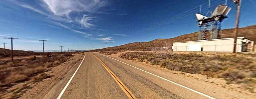
How to reach the communication towers near Granite Pass?
A gravel road east of the pass climbs up to a few communication facilities at an elevation of 1.255m (4117ft) above sea level. The track is narrow and steep. 4x4 vehicle required. It’s 314.94 m (1,033.26 ft) long. The elevation gain is 22 meters and the average gradient is 7.09%.