Take the lonely US 50 and discover Connors Pass in Nevada
Connors Pass is a high mountain pass at an elevation of 2,356m (7,729ft) above sea level, located in central White Pine County, in the US state of Nevada.
Where is Connors Pass?
Set in the Schell Creek Range, in the east-central part of Nevada, the pass, also known as Conners Pass, is named after Colonel P.E. Connors, who established Fort Ruby. It affords great far views of Wheeler Peak.
Is Connors Pass paved?
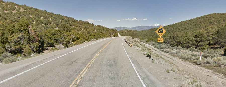
The road through the summit is fully paved. It’s called US Highway 50, nicknamed the Loneliest Highway in America. The road, spliced together with US-6 and US-93 into a single two-lane highway, is a nice road, very smooth and mostly straight. At this elevation, the summit is the highest pass on US 93 and US 50 in the state.
How long is Connors Pass in Nevada?
The pass road is 42.48km (26.9 miles) long, running north-south from Ely (the largest city and county seat of White Pine County) to Majors Place, formerly known as Connors Station. The road is pretty steep, with some parts having up to 8% grades and numerous turns.
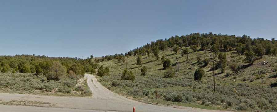
Challenging Gravel Ascent to Communication Facility South of Connors Pass
South of the pass, a minor gravel road climbs up to a communication facility at 2,472m (8,110ft) above sea level. It’s a very steep road, hitting a 10% maximum gradient through some of the ramps. Starting at Connors Pass, the ascent is 1.77km (1.1 miles) long. Over this distance, the elevation gain is 116 meters. The average gradient is 6.55%.
Road suggested by: smokeidaho