What are the most spectacular roads in the USA?
Located in North America, the USA is a true paradise for drivers, as it hosts more than 2,000 roads listed as the most spectacular in the world.
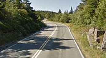
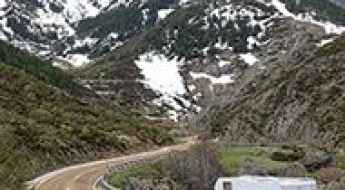
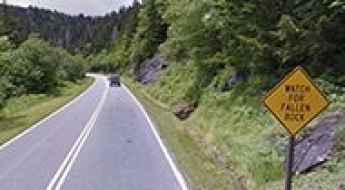
Featuring mountains, deserts, coasts, and snow, in the USA you’ll get your dream road. And you’ll never want to wake up. For instance, at the top of your list, you need to drive the Million Dollar Highway, the most beautiful road in America, and probably in the world. Built in the late 1880s, you'll be on the "outside" for a while with a hell of a view to your right (let the passenger enjoy the view; you'll want to watch the road). Another paved option must be the Iron Mountain Road, featuring 17 miles, 314 curves, 14 switchbacks, 3 pigtails, and 3 tunnels in the Black Hills of South Dakota. No list would be complete without the winding Tail of the Dragon: 318 curves in 11 miles. Spanning Tennessee and North Carolina, it is one of the most scenic drives in the USA. You also can’t skip driving Mount Evans Scenic Byway, the highest paved road in North America, climbing up to 4,310m (14,130ft) in Colorado. It is said to be the highest paved road in North America.
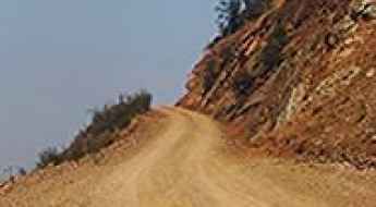
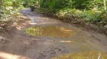
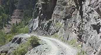
For those who prefer unpaved experiences, the country hosts some of the most defiant yet scenic roads in the world. You can’t miss Black Bear Pass, a high mountain adventure in the Colorado Rockies. Climbing up to 3,915m (12,844ft) above sea level, it's one of the highest roads in Colorado. You can also discover the beauty of Engineer Pass, a mountain pass at an elevation of 3,901m (12,800ft) above sea level in Colorado. It’s mostly a first-gear ride because the road is rough and rocky. The legendary Shafer Trail Road in Utah's Canyonlands National Park is an iconic drive located on the east-central edge of Utah. At times, the road is so narrow that only one car can pass. And Lippincott Mine Road in California is for experienced 4WD drivers using high-clearance vehicles only. You'll need a good map, as the routes are not marked and there are no signs. It’s one of the challenging backcountry roads in Death Valley National Park.
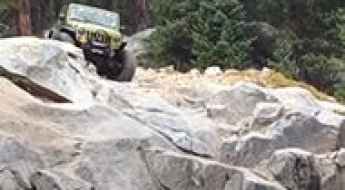
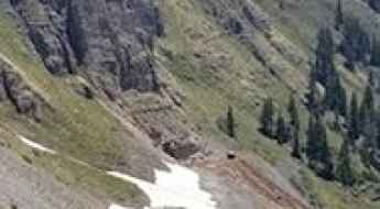
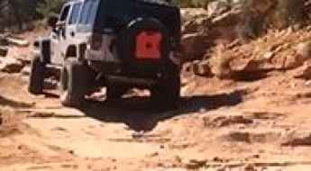
Holy Cross City Jeep Road in Colorado is only for the most experienced drivers
Holy Cross City Jeep Road is a truly breathtaking trail, only for the most experienced drivers, located in Eagle County, in the US state of Colorado. It’s one of the most difficult and popular hardcore roads in the state. Stock vehicles should not attempt this one.
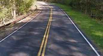
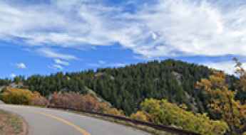
Talimena Scenic Drive is an awe-inspiring road across the Ouachita Mountains
Talimena Scenic Drive is a very scenic drive running across the Ouachita Mountains, straddling the southeastern part of Oklahoma and western Arkansas, in the USA.
Canton Avenue is one of the steepest streets in the USA
Canton Avenue is a little street tucked into a corner of Beechview neighborhood of Pittsburgh, in the US state of Pennsylvania. It’s said to be one of the steepest streets in the United States, with a maximum gradient of 33 percent.
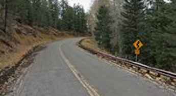
Kancamagus Highway is a scenic drive in New Hampshire during the fall foliage season
Kancamagus Highway is a very scenic drive located in Grafton County, in the U.S. state of New Hampshire. It is said to be one of the most popular fall foliage road trips in the world.
Cadillac Summit Road, a trip to the highest point on the east coast of the USA
Cadillac Mountain is a mountain peak at an elevation of 457m (1,499ft) above sea level located on Mount Desert Island, in Hancock County, in the US state of Maine. It is the highest point on the east coast of the U.S.
The remote Kleinschmidt Grade Road in Idaho will test your nerves
Located in Adams County, in the US state of Idaho, Kleinschmidt Grade Road (Forest Road 050) will test your nerves. It is recommended that beginner riders avoid this road. Keep your eyes on the road, not the scenery.
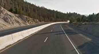
The Best RV Routes Through The Smoky Mountains (Must See!)
Spanning over 500,000 acres along the Tennessee-North Carolina border, the Great Smoky Mountains represent one of the most technically demanding yet rewarding landscapes for recreational vehicle (RV) travel in the United States. Navigating the "Smokies" requires more than just a map; it demands an understanding of steep gradients, high-altitude weather patterns, and the unique atmospheric chemistry—specifically the biogenic isoprene emissions—that gives these peaks their iconic blue mist.
How to get by car to High Rock Bay in Michigan's Keweenaw Peninsula?
High Rock Bay is a very scenic spot located in northeastern Keweenaw County in the U.S. state of Michigan. A variety of vehicles try to make it out to the end, but most will turn around. The road can be rough if there has been rain and it hasn't been graded.
Ultimate 4wd destination: Clear Lake in San Juan NF
Clear Lake is an alpine turquoise lake at an elevation of 3.653m (11,984ft) above sea level, located in San Juan County, in the U.S. state of Colorado. Be sure to have experience in back roads if you attempt this trail. The drive is not for the faint of heart.
A bumpy paved road to Ski Apache in New Mexico
Ski Apache is a ski resort at an elevation of 2.988m (9,803ft) above sea level, located in Lincoln County, in the U.S. state of New Mexico. It’s one of the highest roads in New Mexico. If you've got a fear of heights, this drive could be a little stressful.
Red Grade Road is a beautiful drive with lots of wildlife in Wyoming
Red Grade Road is a very treacherous drive located in Sheridan County, in the US state of Wyoming. It is rough and steep and requires a suitable vehicle.
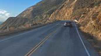
Big Sur Coast Highway is an epic coastal drive in California
Big Sur Coast Highway is a very scenic drive hugging the California coast, in the USA. This twisting, cliff-hugging coastal scenic drive runs from Monterey to San Luis Obispo.
Driving Interstate 90 to Homestake Pass in the Rocky Mountains of Montana
Homestake Pass is a high mountain pass at an elevation of 1.954m (6,410ft) above sea level, located in the US state of Montana.
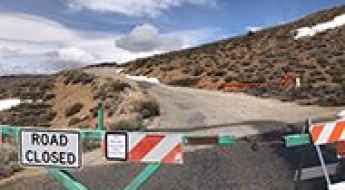
Mount Baker Highway is an extraordinary day trip in Washington
Mount Baker Highway is a very scenic drive located within the Mount Baker-Snoqualmie National Forest in the US state of Washington. The end of the road at Artist Point is only open for 3-4 months in late summer and early fall.
A two mile road to the top of Capulin Volcano in New Mexico
Capulin Volcano is an extinct cinder cone volcano at an elevation of 2,405m (7,890ft) above sea level, located in Union County, in the U.S. state of New Mexico. It’s one of the most accessible volcanoes in the world.
A paved road to the top of Whiteface Mountain in New York
Whiteface Mountain is a high mountain peak at an elevation of 1,402m (4,599ft) above sea level, located in Essex County, in the U.S. state of New York. At this elevation it's said to be the highest paved road in NY.
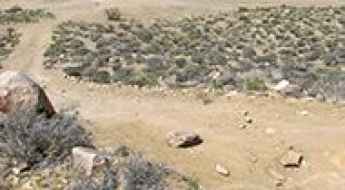
Mengel Pass in California: Only Experienced Drivers with Advanced Off Road Skills
Mengel Pass is a mountain pass at an elevation of 1.314m (4,311ft) above sea level located in Inyo County, in the US state of California. Famous for the site where Charles Manson was captured by police, it is a favorite Jeep trail in Death Valley. Rough 4WD vehicle needed.
Coyote Flat is a steep rocky road for high clearance 4X4's in California
Coyote Flat is a high mountain plateau at an elevation of 3.061m (10,042ft) above sea level, located in Inyo County, in the U.S. state of California. It’s one of the highest roads of California.
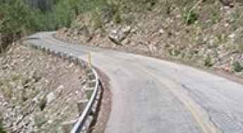
O'Neil Pass is the highest paved road of South Dakota
O'Neil Pass is a mountain pass at an elevation of 2,046m (6,712ft) above sea level, located in Lawrence County, in the U.S. state of South Dakota. It’s said to be the highest paved road of South Dakota.
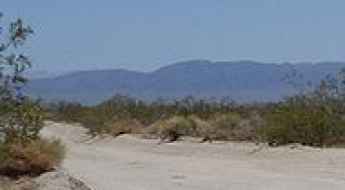
Old Maverick Road is the easiest off-road road in Big Bend NP
Old Maverick Road is a scenic desert back road located in Brewster County, in the U.S. state of Texas. It’s said to be the easiest off-road route in Big Bend National Park.
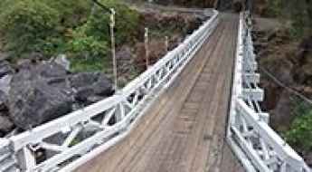
The iconic Mosquito Bridge in California
Located in El Dorado County, in the U.S. state of California, Mosquito Bridge is one of the most spectacular bridges in the world.
Driving the haunted Crawford Road in Virginia
Crawford Road is said to be one of the most haunted roads in the US state of Virginia, a source of local haunting lore for decades. Many people have reported hearing the ghostly sounds of a battle as well as sighting spectral soldiers in the area.

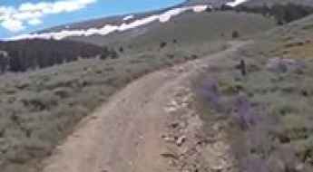
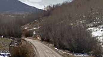
A scenic unpaved road to Buffalo Pass in Colorado
Buffalo Pass is a high mountain pass at an elevation of 3,146m (10,321ft) above sea level, located in the U.S. state of Colorado. It is suitable for most SUVs and some passenger cars with careful tire placement in spots.
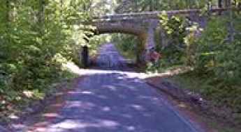
The haunted Witches Bridge in Illinois
Located west of Clarksdale, in Christian County, Illinois, in USA, Witches Bridge is one of the most spectacular bridges in the world.
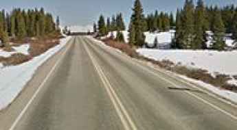
A paved road to Targhee Pass in the Henrys Lake Mountains
Targhee Pass is a high mountain pass at an elevation of 2.161m (7,089ft) above sea level, located on the border between Idaho and Montana, in the USA.
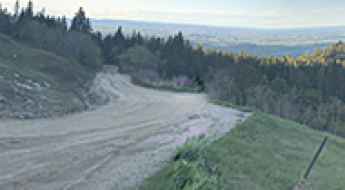
Driving to Crown King, a mining town in Arizona
Crown King is a high mountain mining town at an elevation of 1,765m (5,790ft) above sea level, located in Yavapai County, in the US state of Arizona. Much of the road to the town uses an old railroad bed running across the desert, over gold mines, and through the forest.
Travel guide to the top of Coal Bank Pass in Colorado
Coal Bank Pass is a high mountain pass at an elevation of 3.243m (10,640ft) above sea level, located in San Juan County, in the U.S. state of Colorado.
Chinook Pass is a premier drive in Washington
Chinook Pass is a high mountain pass at an elevation of 1.655m (5,430ft) above sea level, located in Yakima County, in the U.S. state of Washington.
Norris Canyon Road is a scenic drive in Yellowstone NP
Norris Canyon Road is a highly scenic route in the heart of Yellowstone National Park, in the U.S. state of Wyoming. It runs entirely over 2,300m (7,500ft) above sea level.
Top of the World is one of the gnarliest roads of Moab
Top of the World is a natural viewpoint at an elevation of 2,149m (7,050ft) above sea level, located in Moab, Grand County, in the U.S. state of Utah. At the top, you are treated to one killer view from a 3,000-foot cliff overlook. It features one of the most scenic drives and best views in Moab—or perhaps all of Utah.
Arizona Snowbowl is one of the highest roads of Arizona
Arizona Snowbowl is a ski resort at an elevation of 2.912m (9,553ft) above sea level, located in Coconino County, Arizona. It's one of the highest roads in Arizona.
Bobcat Pass is a high mountain road in New Mexico
Bobcat Pass is a high mountain pass at an elevation of 2,995m (9,826ft) above sea level, located in Carson National Forest, in the U.S. state of New Mexico.
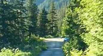
Cascade River Road in Washington is not suitable for large RVs
Cascade River Road is a picturesque mountain route situated in Skagit County, in the U.S. state of Washington.
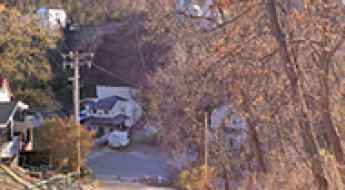
L Road in Nebraska is haunted by the screams of 7 sisters
Located in Otoe County, in the US state of Nebraska, L Road is supposedly haunted by the screams of 7 sisters. If you’re sensitive to sibling drama, you’ll want to stay off this old road.
A narrow dirt road with steep drop offs to Francis Peak in Utah
Francis Peak is a high mountain peak at an elevation of 2.887m (9,471ft) above sea level, located in the U.S. state of Utah. Most cars can make this bumpy journey, though it is a back-country road.
North Cascades Highway is one of Washington's Ultimate Road Trips
North Cascades Highway (State Route 20) is a very scenic drive located in North Cascades National Park, in the US state of Washington. The road is part of the Cascade Loop, a 436-mile (702 km) driving tour through the Cascades in the northern areas of Washington.
An Explorer's Guide to Boriana Mine in Arizona
Boriana Mine is an abandoned tungsten mine at an elevation of 1,711m (5,613ft) above sea level located in Mohave County, in the US state of Arizona. High clearance and four-wheel drive vehicles only.
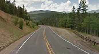
Frying Pan Road is an awe-inspiring route through White River NF
Frying Pan Road is a very scenic uphill drive located in the U.S. state of Colorado. The road runs entirely above 2,000m (6,500ft) above sea level.
Molas Pass is a challenging climb on the Million Dollar Highway
Molas Pass is a high mountain pass at an elevation of 3.328m (10,918ft) above sea level, located in San Juan County, in the U.S. state of Colorado.
What are the highest roads in Oregon?
Located in the Pacific Northwest region on the West Coast of the United States, Oregon is a state of spectacular contrasts, geologically divided by its colossal mountain ranges. Bounded by Washington, Idaho, Nevada, California, and the Pacific Ocean, Oregon is celebrated as one of the most geographically diverse states in the U.S. While known for its rugged coastline, vast forests, and fertile valleys, the state's vertical core is the Cascade Range and other towering mountain systems.
Last Dollar Pass is one of Colorado's best back-country roads
Last Dollar Pass is a high mountain pass at an elevation of 3.254m (10,676ft) above sea level, located in San Miguel County, in the U.S. state of Colorado. It’s said to be one of Colorado's best backcountry roads.
Driving to Clingmans Dome, the Highest Point in the Smokies
Clingmans Dome is a high mountain peak at an elevation of 2,025m (6,643ft) above sea level, located on the border between Tennessee and North Carolina, in the southeastern United States.
Travel guide to Fremont Pass in Colorado
Fremont Pass is a high mountain pass at an elevation of 3.455m (11,335ft) above sea level, located in the U.S. state of Colorado.
How to get by car to Tomboy ghost town in Colorado?
Located in San Miguel County in the U.S. state of Colorado, at an elevation of 3.482m (11,423ft) above sea level, Tomboy ghost town is an old mining town from the 1880s that used to host 1,000 year-round residents. The mine closed in 1927, and the town ceased to exist, though work in the mine tunnel continued until 1978.
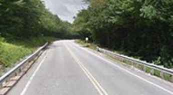
Is Missouri Highway 63 the most dangerous road in the state?
While advancements in vehicles and road safety have made driving generally safer in the USA, certain roads, like Missouri's Highway 63, remain hazardous even in modern times.
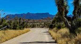
Old Dale Road is an old mining road in Joshua Tree NP
Old Dale Road is a scenic drive located in Joshua Tree National Park, in the US state of California. This old mining road traverses the eastern portion of the park from north to south It’s one of the famous backcountry roads in the Joshua Tree National Park.
White Mountain Road has taxed the nerves of more than a few drivers in California
White Mountain Road is a very scenic mountain road located in Inyo County, in the U.S. state of California. It’s one of the highest roads in California.
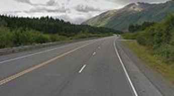
Seward Highway is an awe-inspiring route in Alaska
Seward Highway is a very scenic drive located in the U.S. state of Alaska. The drive is full of amazing scenery. Every direction is gorgeous and interesting.