What are the most spectacular roads in the USA?
The vast expanse of the USA, stretching from the amber waves of grain to the majestic purple mountain majesties, boasts a network of roads that are as diverse as the nation's tapestry of cultures. One such road, the Million Dollar Highway, is often touted as America's crown jewel of roadways, leading adventurers through awe-inspiring terrains and offering unparalleled vistas. Further north, the Iron Mountain Road, with its dizzying 314 curves, 14 switchbacks, 3 pigtails, and 3 tunnels, stands as a testament to man's desire to conquer nature, providing a thrilling drive that's not for the faint-hearted.
Journey to Colorado, and you'll find yourself face to face with the infamous Black Bear Pass - a road that promises not just breathtaking beauty, but also adrenaline-pumping excitement. For the off-road enthusiasts, Engineer Pass offers an opportunity to get up close and personal with Colorado's high mountain terrains, challenging drivers to push their limits amidst staggering beauty. Not to be outdone, Utah’s Canyonlands beckons with the Shafer Trail Road, an iconic route that cuts through the heart of some of the most stunning canyons, making you feel like you're driving through the very pages of history.
In the USA, each road is a journey, an exploration, a challenge, and a story. They are gateways to discovering the grandeur of the nation, to feeling the pulse of its land, and to embracing the spirit of adventure that is quintessentially American. Whether bathed in the golden hues of sunrise or shrouded in the mysteries of twilight, these roads promise experiences that linger long after the journey's end.
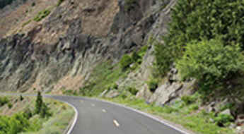
The unforgettable road to Dunraven Pass, the highest pass in Yellowstone
Dunraven Pass is a high mountain pass at an elevation of 2.718m (8,917ft) above sea level, located in Park County, in the U.S. state of Wyoming. At this elevation, it is the highest pass inside the park.
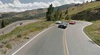
McClure Pass is one of the steepest paved roads of Colorado
McClure Pass is a high mountain pass at an elevation of 2.681m (8,795ft) above sea level, located in the US state of Colorado. It’s one of the steepest paved roads in the state, hitting a 9% maximum gradient.
Railroad Ridge is the highest road in Idaho
Railroad Ridge is a high mountain ridge at an elevation of 3.180m (10,433ft) above sea level located in Custer County, in the US state of Idaho. It’s definitely not for the faint of heart. It’s said to be the highest road accessible to full-size vehicles in Idaho.
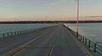
Mackinac Bridge in MI: the biggest fear is the wind
Mackinac Bridge divides the Upper and Lower peninsulas of Michigan. It was built in 1957, is 26,372 feet long and ascends to a height of 200 feet above water. Some drivers get so nervous about crossing the bridge that they don’t even go. And this happens so often that the Mackinac Bridge Authority will drive your car or motorcycle for you (and for free). It’s one of the most spectacular bridges in the world.
Mount Baker Highway is an extraordinary day trip in Washington
Mount Baker Highway is a very scenic drive located within the Mount Baker-Snoqualmie National Forest in the US state of Washington. The end of the road at Artist Point is only open for 3-4 months in late summer and early fall.
Dillon Road is a dangerous drive through the open desert of California
Dillon Road is an isolated drive through the open desert, located in Riverside County, in the U.S. state of California.
Kancamagus Highway is a scenic drive in New Hampshire during the fall foliage season
Kancamagus Highway is a very scenic drive located in Grafton County, in the U.S. state of New Hampshire. It is said to be one of the most popular fall foliage road trips in the world.
A two mile road to the top of Capulin Volcano in New Mexico
Capulin Volcano is an extinct cinder cone volcano at an elevation of 2,405m (7,890ft) above sea level, located in Union County, in the U.S. state of New Mexico. It’s one of the most accessible volcanoes in the world.
A truly epic road to Kennebec Pass in Colorado
Kennebec Pass is a high mountain pass at an elevation of 3,561m (11,683ft) above sea level, located in La Plata County, in the U.S. state of Colorado. 4WD with good clearance is needed for the last section of the road.
Baxter Pass: Ultimate 4wd Destination in Colorado
Baxter Pass is a high mountain pass at an elevation of 2.573m (8,441ft) above sea level, located in Garfield County, in the U.S. state of Colorado. High-clearance 4WDs are recommended, though most stock SUVs are acceptable.
The Best RV Routes Through The Smoky Mountains (Must See!)
With around 187,000 acres of land, the Great Smoky Mountains are a major attraction of the USA that thousands of people flock to every year. This large area of land stretches along the Tennessee-North Carolina border.
Holy Cross City Jeep Road in Colorado is only for the most experienced drivers
Holy Cross City Jeep Road is a truly breathtaking trail, only for the most experienced drivers, located in Eagle County, in the US state of Colorado. It’s one of the most difficult and popular hardcore roads in the state. Stock vehicles should not attempt this one.
Ultimate 4wd destination: Clear Lake in San Juan NF
Clear Lake is an alpine turquoise lake at an elevation of 3.653m (11,984ft) above sea level, located in San Juan County, in the U.S. state of Colorado. Be sure to have experience in back roads if you attempt this trail. The drive is not for the faint of heart.
The road to Monida Pass on the border of Idaho and Montana
Monida Pass is a high mountain pass at an elevation of 2,102m (6,896ft) above sea level, located on the border of Idaho and Montana, in the USA.
A rough road to the beautiful Goose Lake in New Mexico
Goose Lake is a high mountain lake at an elevation of 3.570m (11,712ft) above sea level, located in Taos County, in the U.S. state of New Mexico. This drive is worth it, but be forewarned of the difficulty. It’s one of the highest roads in New Mexico.
What are the highest roads in Idaho?
Located in the northwestern region of the United States, Idaho contains hundreds of individual mountain ranges an unspoiled beauty. It has the most rugged terrain in the country, with 114 named mountain ranges and fifty mountain peaks having an elevation of 10,000 feet above sea level. Literally covered from north to south by the Rocky Mountains, the State is known for its mountainous landscapes and vast swaths of protected wilderness and outdoor recreation areas.
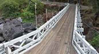
The iconic Mosquito Bridge in California
Located in El Dorado County, in the U.S. state of California, this small suspension bridge was originally built in 1867 and reconstructed on the existing foundations in 1939. The road over the bridge is called Mosquito Road. It’s one of the most spectacular bridges in the world.
Archer Avenue is one of the most haunted roads in the Chicago area
Archer Avenue is probably one of the most haunted areas in all of the Chicago area, in the USA. Along this route, there are a number of locations that boast more than their share of ghosts. The paranormal activity on the roadway seems to be anchored at both ends by cemeteries, both of which have their own ghost stories.
What are the highest roads in Arizona?
Located in the southwestern region of the United States, Arizona is the sixth largest state in the country in terms of area. Part of the Mountain West states, Arizona is best known for its desert landscape. It can be divided into three major land areas; the Colorado plateau, the Transition Zone and the Basin and Ridge Region. The state is also known for its climate, which has very hot summers and mild winters.
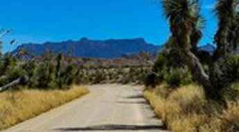
Old Maverick Road is the easiest off-road road in Big Bend NP
Old Maverick Road is a scenic desert back road located in Brewster County, in the U.S. state of Texas. It’s said to be the easiest off-road route in Big Bend National Park.
North Ogden Divide is an awe-inspiring road in Utah
North Ogden Divide is a high mountain pass at an elevation of 1,887m (6,190ft) above sea level, located in Weber County, in the US state of Utah.
Cascade River Road in Washington is not suitable for large RVs
Cascade River Road is a picturesque mountain route situated in Skagit County, in the U.S. state of Washington.
Antelope Canyon Road in Arizona is pure adventure
Located in the U.S. state of Arizona, Antelope Canyon Road is the access road to the most-visited and most-photographed slot canyon in the American Southwest. The road is actually a riverbed.
A bumpy paved road to Ski Apache in New Mexico
Ski Apache is a ski resort at an elevation of 2.988m (9,803ft) above sea level, located in Lincoln County, in the U.S. state of New Mexico. It’s one of the highest roads in New Mexico. If you've got a fear of heights, this drive could be a little stressful.
A paved road to the top of Whiteface Mountain in New York
Whiteface Mountain is a high mountain peak at an elevation of 1,402m (4,599ft) above sea level, located in Essex County, in the U.S. state of New York. At this elevation it's said to be the highest paved road in NY.
A paved road to Targhee Pass in the Henrys Lake Mountains
Targhee Pass is a high mountain pass at an elevation of 2.161m (7,089ft) above sea level, located on the border between Idaho and Montana, in the USA.
Travel guide to the top of Coal Bank Pass in Colorado
Coal Bank Pass is a high mountain pass at an elevation of 3.243m (10,640ft) above sea level, located in San Juan County, in the U.S. state of Colorado.
An epic road to Mount Lemmon in Arizona
Mount Lemmon is a high mountain peak at an elevation of 2.792m (9,159ft) above sea level, located in Pima County, in the U.S. state of Arizona. This favorite of Arizona cyclists is known for its hill climb. It's one of the highest roads in Arizona.
A scenic unpaved road to Buffalo Pass in Colorado
Buffalo Pass is a high mountain pass at an elevation of 3,146m (10,321ft) above sea level, located in the U.S. state of Colorado. It is suitable for most SUVs and some passenger cars with careful tire placement in spots.
Arizona Snowbowl is one of the highest roads of Arizona
Arizona Snowbowl is a ski resort at an elevation of 2.912m (9,553ft) above sea level, located in Coconino County, Arizona. It's one of the highest roads in Arizona.
Old Dale Road is an old mining road in Joshua Tree NP
Old Dale Road is a scenic drive located in Joshua Tree National Park, in the US state of California. This old mining road traverses the eastern portion of the park from north to south It’s one of the famous backcountry roads in the Joshua Tree National Park.
How to get by car to High Rock Bay in Michigan's Keweenaw Peninsula?
High Rock Bay is a very scenic spot located in northeastern Keweenaw County in the U.S. state of Michigan. A variety of vehicles try to make it out to the end, but most will turn around. The road can be rough if there has been rain and it hasn't been graded.
What are the highest roads in Washington?
Located in the Pacific Northwest region of the United States, Washington is the 18th largest state. Lying at the northwestern corner of the 48 conterminous states, it’s bordered by Canada in the north and Oregon in the south. On the east, it’s bordered by Idaho and, on the west, it’s bordered by the Pacific Ocean.
How to get by car to Tomboy ghost town in Colorado?
Located in San Miguel County in the U.S. state of Colorado, at an elevation of 3.482m (11,423ft) above sea level, Tomboy ghost town is an old mining town from the 1880s that used to host 1,000 year-round residents. The mine closed in 1927, and the town ceased to exist, though work in the mine tunnel continued until 1978.
Driving the scenic Arizona State Route 260
Arizona State Route 260 is a very scenic high mountain road located in the north-central part of the U.S. state of Arizona.
Bobcat Pass is a high mountain road in New Mexico
Bobcat Pass is a high mountain pass at an elevation of 2,995m (9,826ft) above sea level, located in Carson National Forest, in the U.S. state of New Mexico.
The remote Kleinschmidt Grade Road in Idaho will test your nerves
Located in Adams County, in the US state of Idaho, Kleinschmidt Grade Road (Forest Road 050) will test your nerves. It is recommended that beginner riders avoid this road. Keep your eyes on the road, not the scenery.
Chinook Pass is a premier drive in Washington
Chinook Pass is a high mountain pass at an elevation of 1.655m (5,430ft) above sea level, located in Yakima County, in the U.S. state of Washington.
Last Dollar Pass is one of Colorado's best back-country roads
Last Dollar Pass is a high mountain pass at an elevation of 3.254m (10,676ft) above sea level, located in San Miguel County, in the U.S. state of Colorado. It’s said to be one of Colorado's best backcountry roads.
A narrow dirt road with steep drop offs to Francis Peak in Utah
Francis Peak is a high mountain peak at an elevation of 2.887m (9,471ft) above the sea level, located on the boundary between Davis and Morgan Counties, in the U.S. state of Utah. Most cars can make this bumpy journey, though it is a back-country road.
Norris Canyon Road is a scenic drive in Yellowstone NP
Norris Canyon Road is the name of a highly scenic trip in the heart of Yellowstone National Park, in the U.S. state of Wyoming. It runs entirely over 2.300m above the sea level.
Vermont Street is the curviest street of San Francisco
Located in the Potrero Hill district of San Francisco, in Northern California, Vermont Street is said to be the crookedest street in the United States. Hold on to the steering wheel and get ready for a series of hairpin turns on a stretch of roadway that few travelers and locals know about.
Travel guide to Fremont Pass in Colorado
Fremont Pass is a high mountain pass at an elevation of 3.455m (11,335ft) above the sea level, located on the boundary of Lake and Summit counties, in the U.S. state of Colorado.
North Cascades Highway is one of Washington's Ultimate Road Trips
North Cascades Highway (State Route 20) is a very scenic drive located in the North Cascades National Park, in Washington, USA. The road is part of the Cascade Loop, a 436 miles (702 km) driving tour through the Cascades, in the northern areas of Washington.
Cadillac Summit Road, a trip to the highest point on the east coast of the USA
Cadillac Mountain is a mountain peak at an elevation of 457m (1,499ft) above the sea level located on Mount Desert Island, in Hancock County, in the US state of Maine. It is the highest point on the east coast of the U.S.
O'Neil Pass is the highest road of South Dakota
O'Neil Pass is a mountain pass at an elevation of 2.046m (6,712ft) above the sea level, located in Lawrence County, in the U.S. state of South Dakota. It’s said to be the highest paved road of South Dakota.
Jones Pass in CO may be intimidating to novice drivers
Jones Pass is a high mountain pass at an elevation of 3.804m (12,480ft) above the sea level, located on the boundary of Clear Creek and Grand counties, in the U.S. state of Colorado. The road to the summit has a relatively good road surface given its high altitude. It's one of the highest roads of Colorado.
A mining road to Mount Patterson in California
Mount Patterson is a high mountain peak at an elevation of 3.560m (11,679ft) above the sea level, located in Mono County, in the east central portion of the U.S. state of California, near the Nevada border. It’s one of the highest roads of California.
