What are the most spectacular roads in the USA?
The vast expanse of the USA, stretching from the amber waves of grain to the majestic purple mountain majesties, boasts a network of roads that are as diverse as the nation's tapestry of cultures. One such road, the Million Dollar Highway, is often touted as America's crown jewel of roadways, leading adventurers through awe-inspiring terrains and offering unparalleled vistas. Further north, the Iron Mountain Road, with its dizzying 314 curves, 14 switchbacks, 3 pigtails, and 3 tunnels, stands as a testament to man's desire to conquer nature, providing a thrilling drive that's not for the faint-hearted.
Journey to Colorado, and you'll find yourself face to face with the infamous Black Bear Pass - a road that promises not just breathtaking beauty, but also adrenaline-pumping excitement. For the off-road enthusiasts, Engineer Pass offers an opportunity to get up close and personal with Colorado's high mountain terrains, challenging drivers to push their limits amidst staggering beauty. Not to be outdone, Utah’s Canyonlands beckons with the Shafer Trail Road, an iconic route that cuts through the heart of some of the most stunning canyons, making you feel like you're driving through the very pages of history.
In the USA, each road is a journey, an exploration, a challenge, and a story. They are gateways to discovering the grandeur of the nation, to feeling the pulse of its land, and to embracing the spirit of adventure that is quintessentially American. Whether bathed in the golden hues of sunrise or shrouded in the mysteries of twilight, these roads promise experiences that linger long after the journey's end.
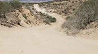
Grapevine Hills Road, a bumpy drive in Big Bend NP
Grapevine Hills Road, also known as Grapevine Spring, is an improved dirt road located in Brewster County, in the western part of the U.S. state of Texas. Some areas can be very rough and you’ll need to be cautious.
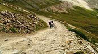
Driving the road to Prospect Mountain is not a piece of cake
Prospect Mountain is a high mountain peak at an elevation of 3.829m (12,562ft) above the sea level, located in Lake County, in the U.S. state of Colorado. It’s one of the highest mountain roads of Colorado.
Travel guide to the top of Angel Peak in NV
Angel Peak is a high mountain peak at an elevation of 2.707m (8,881ft) above the sea level, located in Clark County, in the US state of Nevada.
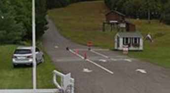
Mount Mansfield
Mount Mansfield is a mountain peak at an elevation of 1.216m (3,989ft) above the sea level, located in Lamoille County, northern Vermont, in USA. The road to the summit offers spectacular views along the way between twists and turns.
The Ultimate Guide to Traveling the Phillips Mine Road
Located in Gila County, Central Arizona, in USA, Phillips Mine Road is a short scenic drive into a seldom seen part of Arizona mining history.
Lemoigne Canyon Road, one of the gnarliest roads in Death Valley NP
Lemoigne Canyon Road is a very exciting very slow, rocky drive located in Inyo County, in the eastern central part of the U.S. state of California. It’s one of the challenging Backcountry roads in the Death Valley National Park.
A memorable road trip to Green Mountain in NM
Green Mountain is a high mountain peak at an elevation of 3.407m (11,177ft) above the sea level, located in Colfax County, in the U.S. state of New Mexico. The road to the summit is an old logging road and is not well maintained. It’s one of the highest mountain roads of New Mexico.
A steep unpaved road to the summit of Picuris Peak
Picuris Peak is a high mountain peak at an elevation of 3.280m (10,761ft) above the sea level, located in Taos County, in northern New Mexico, in the southwestern United States. It’s one of the highest mountain roads of New Mexico.
A scenic paved road to Dinkey Creek
Dinkey Creek Road is a very scenic drive located in Fresno County, in the central portion of the U.S. state of California.
The road to Fix It Pass is not for the faint of heart
Fix It Pass is a high mountain pass at an elevation of 1.899m (6,230ft) above the sea level, located in Emery County, in east-central Utah, United States. The trail has recently become worse than in the past.
The Wild Road to Kennaday Peak in WY
Kennaday Peak is a high mountain peak at an elevation of 3.300m (10,826ft) above the sea level, located in Carbon County, in southern Wyoming, in USA. A high clearance vehicle is recommended. It's one of the highest roads of Wyoming.
A smooth road to Jubilee Pass in Death Valley NP
Jubilee Pass is a mountain pass at an elevation of 403m (1,322ft) above the sea level, located in Inyo County, in the eastern central part of the U.S. state of California.
Nellie Creek Road
Located in the San Juan Mountains, in Hinsdale County, Colorado, in USA, Nellie Creek Road (FSR#877) is very gnarly.
Big Four Mine: The Ultimate Road Trip Guide
Big Four Mine, also known as the War Eagle Mine, is an abandoned mine located in Inyo County, in the eastern central part of the U.S. state of California. It’s one of the challenging Backcountry roads in the Death Valley National Park.
A memorable road trip to Virginia Lakes in CA
Virginia Lakes is the name given to eight pristine alpine lakes in Mono County in the east central portion of the U.S. state of California. A road leads to three of them: Trumbull, Little Virginia and Big Virginia. Topping out at 2.993m (9,819ft) above the sea level it's one of the highest roads of California.
Adventure along the Dagger Flat Auto Trail
Dagger Flat Auto Trail, also known as Dagger Flat Road, is a very scenic graded gravel road located in the Big Bend National Park, in the western part of the U.S. state of Texas.
Ultimate 4wd destination: Fairview Peak
Fairview Peak is a high mountain peak at an elevation of 3.781m (12,404ft) above the sea level, located in Gunnison County, in the U.S. state of Colorado. It’s one of the highest mountain roads of Colorado.
Travel guide to the top of Barlow Pass in WA
Barlow Pass is a mountain pass at an elevation of 718m (2,355ft) above the sea level, located in Snohomish County, in the U.S. state of Washington.
A very intimidating trail to Imperial Express SuperChair
Imperial Express SuperChair is said to be one of the highest chairlifts in North America. Located in Summit County, Colorado, in USA, the chairlift lies at an elevation of 3.652m (11,981ft) above the sea level, just about 100 feet from the very top of Peak 8.
Travelling the most scenic Joshua Tree backcountry roads
Located at the eastern end of Southern California, in USA, the Joshua Tree National Park is immense, nearly 800,000 acres, and infinitely variable. Two desert systems, the Mojave and the Colorado, divide the park into two arid ecosystems. A fascinating variety of plants and animals make their homes in a land sculpted by strong winds and occasional torrents of rain. For your own safety and for the protection of the natural features of the park please stay on established roads.
The Road To Bridger Peak Has it All!
Bridger Peak is a high mountain peak at an elevation of 3.355m (11,007ft) above the sea level, located in Carbon County, in the U.S. state of Wyoming. It’s one of the highest mountain roads of Wyoming.
Driving the Furnace Creek Road in Death Valley NP
Furnace Creek Road is a very exciting desert drive located in Inyo County, in the eastern central part of the U.S. state of California. High-clearance vehicle required. Due to frequent flooding in the area, road conditions often vary throughout the park. It’s one of the challenging Backcountry roads in the Death Valley National Park.
The Ultimate Guide to Traveling the Anniversary Mine Road
Anniversary Mine Road is a very scenic drive located in Clark County, in the U.S. state of Nevada. It requires a carefully driven high-clearance vehicle, although 4WD would be safer.
Conquering the Wild Horse Road in the Mojave Desert
Wild Horse Road is a 18.50km (11.5 miles) scenic drive located in the Mojave Desert of San Bernardino County, California, USA. 4wd vehicle recommended. Its southern end is sandy and soft for two miles.
Travel guide to the top of Mount Waas
Mount Waas is a high mountain peak located in Grand County, in the U.S. state of Utah. Set high in the Northern La Sal Mountains, the summit is accessed by either Beaver Basin or Miner’s Basin.
Deer Creek Road
Located in Ventura County, California, United States, Deer Creek Road is said to be one of the Best Driving Roads in California. The road is very steep (up to 12%). A sense of vertigo makes your hands sweat.
Victor Pass: a road through mining history
Victor Pass is a high mountain pass at an elevation of 3.115m (10,219ft) above the sea level, located in Teller County, in the U.S. state of Colorado.
Mangas Mountain
Mangas Mountain is a high mountain peak at an elevation of 2.948m (9,671ft) above the sea level, located in Catron County, New Mexico, in USA.
A memorable road trip to Mount Marston in MT
Mount Marston is a high mountain peak at an elevation of 2.238m (7,342ft) above the sea level, located in Lincoln County, in the U.S. state of Montana.
A dirt road to the top of Pelican Butte in Oregon
Pelican Butte is a dormant shield volcano at an elevation of 2.450m (8,037 ft) above the sea level, located in Klamath County, in southern Oregon, USA. It’s one of the highest roads of Oregon.
An old mine road to Eagle Pass
Eagle Pass is a high mountain pass at an elevation of 3.602m (11,817ft) above the sea level located in La Plata County, in the U.S. state of Colorado.
Travelling through the historic Deadman Summit
Deadman Summit is a high mountain pass at an elevation of 2.453m (8,047ft) above the sea level, located in Mono County, in the east central portion of the U.S. state of California.
Taos Ski Valley: Road trip guide
Taos Ski Valley is a village and a ski resort at an elevation of 2.878m (9,442ft) above the sea level, located in Taos County, in the northern part of New Mexico, in United States.
The blocked Plum Brook Road Bridge in NY
Plum Brook Road Bridge is a closed bridge over the Muscoot Reservoir, located in northern Westchester County, New York, in USA. It’s one of the most spectacular bridges in the world.
A 5 stars road to Libby Flats Observation Area in the Rocky Mountains
Libby Flats Observation Area is an observation tower at an elevation of 3.313m (10,869ft) above the sea level, located in Albany County, in Wyoming, USA. It's one of the highest roads of Wyoming.
The Ultimate Road Trip Guide to Square Mountain
Square Mountain is a high mountain peak at an elevation of 2.435m (7,988ft) above the sea level located in Idaho County, in the U.S. state of Idaho.
Ultimate 4wd destination: Bill Williams Mountain in AZ
Bill Williams Mountain is a high mountain peak at an elevation of 2.822m (9,259ft) above the sea level, located in Coconino County, in the north-central part of the U.S. state of Arizona. It's one of the highest mountain roads of Arizona.
Driving the East End Road in AK
East End Road is a very scenic drive at the head of Kachemak Bay on the Kenai Peninsula, Alaska, in United States
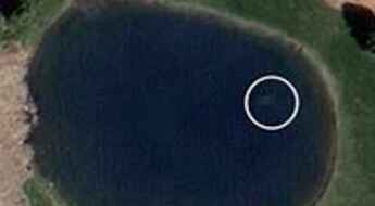
Car with body of man missing 9 years visible on Google Maps
The body of Davie Lee Niles, a man disappeared on October 11, 2006 after he was seen leaving Jake's Bar in Byron Township, Michigan, has been found inside a sunken car - which has been visible on Google Maps for years.
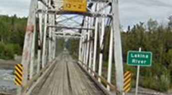
The legend of Lakina River Bridge in Alaska
Located in Valdez-Cordova Census Area, Alaska, United States, the Lakina River Bridge is one of the most spectacular bridges in the world.
Driving the scenic Chisos Basin Road in Big Bend NP
Located in West Texas, the Chisos Basin Road is a very scenic journey with sharp curves and switchbacks through one of America's true hidden gems: the Big Bend National Park.
A road to Keys View, the principal overlook in Joshua Tree NP
Keys View is a very scenic overlook at an elevation of 1.574m (5,164ft) above the sea level, located in Riverside County, in the southern portion of the U.S. state of California, in Joshua Tree National Park.
A memorable road trip to Mount Sherman in Colorado
Mount Sherman is a high mountain peak locatedo on the boundary between Park and Lake counties in the U.S. state of Colorado.
Travel guide to the top of Mount Withington in NM
Mount Withington is a high mountain peak at an elevation of 3.087m (10,127ft) above the sea level, located in Socorro County, in the U.S. state of New Mexico. It’s one of the highest mountain roads of New Mexico.
An old mining road to the summit of Mosquito Peak
Mosquito Peak is a high mountain peak at an elevation of 4.165m (13,664ft) above the sea level, located in Lake County, in central Colorado, in the United States. It's one of the highest roads of USA.
Casner Mountain Trail, The Road That Has It All!
Located on the boundary between Yavapai and Coconino counties, in the north-central part of the U.S. state of Arizona, Casner Mountain Trail No. 8 is one of the most scenic and rugged trails in Arizona. It’s designated as a motorized trail with very rugged conditions along a narrow ridge with limited opportunity for two-way traffic.
The road to Sheep Mountain in California isn’t an easy one
Sheep Mountain is a high mountain pass at an elevation of 3.626m (11,896ft) above the sea level, located in Mono County, in the east central portion of the U.S. state of California. It's one of the highest roads of California.
A scenic drive to Glacier Point
Glacier Point is a viewpoint at an elevation of 2.198m (7,211ft) above the sea level, located in Mariposa County, in the U.S. state of California.
