What are the most spectacular roads in the USA?
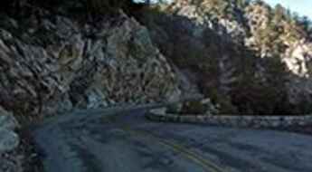
The vast expanse of the USA, stretching from the amber waves of grain to the majestic purple mountain majesties, boasts a network of roads that are as diverse as the nation's tapestry of cultures. One such road, the Million Dollar Highway, is often touted as America's crown jewel of roadways, leading adventurers through awe-inspiring terrains and offering unparalleled vistas. Further north, the Iron Mountain Road, with its dizzying 314 curves, 14 switchbacks, 3 pigtails, and 3 tunnels, stands as a testament to man's desire to conquer nature, providing a thrilling drive that's not for the faint-hearted.
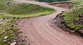
Journey to Colorado, and you'll find yourself face to face with the infamous Black Bear Pass - a road that promises not just breathtaking beauty, but also adrenaline-pumping excitement. For the off-road enthusiasts, Engineer Pass offers an opportunity to get up close and personal with Colorado's high mountain terrains, challenging drivers to push their limits amidst staggering beauty. Not to be outdone, Utah’s Canyonlands beckons with the Shafer Trail Road, an iconic route that cuts through the heart of some of the most stunning canyons, making you feel like you're driving through the very pages of history.
In the USA, each road is a journey, an exploration, a challenge, and a story. They are gateways to discovering the grandeur of the nation, to feeling the pulse of its land, and to embracing the spirit of adventure that is quintessentially American. Whether bathed in the golden hues of sunrise or shrouded in the mysteries of twilight, these roads promise experiences that linger long after the journey's end.
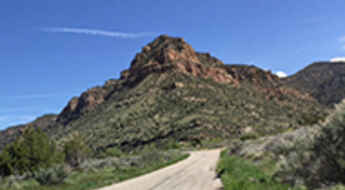
The Ultimate Road Trip To Flat Iron Mesa in Carbon County
Flat Iron Mesa is a high mountain peak at an elevation of 2.171m (7,122ft) above the sea level, located in Carbon County, in the US state of Utah.
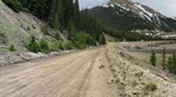
Road trip guide: Conquering Urad Lake in Colorado
Lake Urad is a high mountain lake at an elevation of 3.288m (10,787ft) above the sea level, located in the U.S. state of Colorado. Full size vehicles should not attempt to drive all the way, as there are a few very narrow spots.
Brynwood Hillclimb is one of the steepest roads in Oregon
Nestled in the West Hills of Portland, Oregon, in the USA, Brynwood is renowned as the steepest climb in the state, featuring grades exceeding 24% in some sections. Reaching the top will leave your lungs burning.
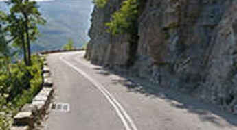
Driving the scenic Going-to-the-Sun Road to Logan Pass in Glacier National Park
Logan Pass is a high mountain pass at an elevation of 2,026m (6,646ft) above sea level, located on the boundary between Flathead and Glacier counties in the U.S. state of Montana.
Driving the rough 4x4 road to Poughkeepsie Pass in Colorado
Poughkeepsie Pass is a high mountain pass at an elevation of 3.938m (12,919ft) above the sea level, located in San Juan County, in the US state of Colorado. It’s a challenging trail that should only be attempted by those who how have pretty build vehicle capable of handling tough conditions. It’s one of the highest roads of Colorado.
A Memorable Road to Daylight Pass in Death Valley
Daylight Pass is a high mountain pass at an elevation of 1,316m (4,317ft) above sea level, located in Inyo County, in the U.S. state of California.
Driving the wild road to Mount Ord in Arizona
Mount Ord is a high mountain peak at an elevation of 2,173m (7,128ft) above sea level, located in Maricopa County, in the US state of Arizona. A high-clearance vehicle is recommended.
How to Travel New Mexico State Road 126
NM-126 is a highly scenic drive situated in the heart of Sandoval County, in the U.S. state of New Mexico. It offers breathtaking views, but the graded dirt road section can be intimidating.
The outstanding 4x4 road to Bill Moore Lake in Colorado
Bill Moore Lake is a beautiful alpine lake at an elevation of 3,465m (11,368ft) above sea level, located in Clear Creek County, in the US state of Colorado.
Darland Mountain is a truly outstanding 4x4 adventure in Washington
Darland Mountain is a high mountain pass at an elevation of 2,129m (6,984ft) above sea level, located in Yakima County, in the U.S. state of Washington. It’s one of the highest roads in Washington.
Driving the wild Sheep Creek Truck Trail in California
Sheep Creek Truck Trail is a scenic mountain road located in San Bernardino County, in the US state of California.
Valley of Fire Highway is an iconic drive in Nevada
Valley of Fire Highway is a very scenic drive located in northeastern Clark County, in the US state of Nevada. The drive is honored for its surrounding beauty as well.
Gold Belt Scenic Byway is a scenic drive through Colorado's gold country
Gold Belt Scenic Byway is a very exciting journey through Colorado’s former mining country. It offers breathtaking scenery that you won't find anywhere else.
The legendary Forest Road 825 in Colorado was built in 1883
Forest Road 825 is a high mountain road located in San Juan County, in the U.S. state of Colorado. It’s one of the highest roads of Colorado.
Conquering the drained Lake Emma in San Juan County by car
Lake Emma is a drained lake at an elevation of 3,809m (12,496ft) above sea level, located in San Juan County, in the US state of Colorado. Mining was being conducted under the lake when, in June 1978, the roof of the stope collapsed, flooding the mine and draining the lake. It’s one of the highest roads of Colorado.
Coffee Pot Road #600 is an improved gravel road in Colorado
Located in Garfield County, in the U.S. state of Colorado, Coffee Pot Road #600 offers both beautiful scenery and views. The trail begins climbing immediately, through switchbacks and near big drop-offs with no guardrails.
FR123 is a wild road in the Tushar Mountains of Utah
Forest Road 123 (FR123) is a highly challenging high mountain drive located in Piute County, in the US state of Utah. It's one of the highest roads in Utah, topping out at 3,503m (11,492ft) above sea level.
A sensational drive to Mount Wilson in California
Mount Wilson is a high mountain peak at an elevation of 1,727m (5,666ft) above the sea level, located in Los Angeles County, in the U.S. state of California.
Washington Pass is the highest point of North Cascades Highway
Washington Pass is a high mountain pass at an elevation of 1,669m (5,477ft) above sea level, located on the boundary of Chelan and Okanogan counties, in the U.S. state of Washington.
A challenging paved road to Onyx Summit in California
Onyx Summit is a high mountain pass at an elevation of 2,579m (8,461ft) above sea level, located in San Bernardino County, in the US state of California.
How to get to Monjeau Peak in New Mexico by car?
Monjeau Peak is a high mountain peak at an elevation of 2,927m (9,603ft) above the sea level, located in Lincoln County, in the U.S. state of New Mexico.
Pleasant Canyon Road is a challenging drive in Death Valley NP
Pleasant Canyon Road/South Park 4x4 Loop is a highly challenging trail situated in Death Valley National Park, in the US state of California. A rough 4WD vehicle is necessary due to washouts and large boulders. This narrow, rocky road is suitable for experienced 4WD drivers only, ranking as one of the challenging Backcountry roads in Death Valley National Park.
Sherman Pass is Washington’s highest maintained road
Sherman Pass is a high mountain pass at an elevation of 1,684m (5,524ft) above sea level, located in Ferry County, in the U.S. state of Washington. It is said to be the highest pass in the state maintained all year.
Driving the tough Dishpan Springs Trail in San Bernardino NF
Dishpan Springs Trail is a short but demanding off-road challenge located in San Bernardino County, in the U.S. state of California.
Driving the historic road to Bridger Pass in Wyoming
Bridger Pass is a high mountain pass at an elevation of 2,322m (7,618ft) above the sea level, located in Carbon County, in the US state of Wyoming.
A remote unpaved road to Aguereberry Point in Death Valley NP
Aguereberry Point is a natural overlook at an elevation of 1,960m (6,433ft) above the sea level, located in Inyo County, in the US state of California. It’s one of the challenging Backcountry roads in Death Valley National Park.
An epic enthralling road to Monroe Peak in Utah
Monroe Peak is a high mountain peak at an elevation of 3.421m (11,223ft) above the sea level, located in Sevier County, in the U.S. state of Utah. It’s one of the highest roads in Utah.
Ultimate 4WD Destination in California: Bull Creek Road (Burma Grade Trail)
Bull Creek Road (Burma Grade Trail) is a backcountry trail located just outside Yosemite National Park, near Briceburg, in Mariposa County, in the U.S. state of California.
How to Travel the Mount Nebo Scenic Byway in Utah
Mount Nebo Scenic Byway (Nebo Loop) is a drive with rewarding views located in the Uinta National Forest, in the US state of Utah. The road tops out at 2,850m (9,353ft) above sea level at the Monument trailhead. It’s a mountain road with spectacular views of the Wasatch Range.
Driving the scenic Jenny Lake Loop Road in Wyoming
Jenny Lake Loop Road is a very scenic drive skirting the east shore of Jenny Lake, in Teton County, in the U.S. state of Wyoming.
Rock Creek Vista Point is a must-stop on the Beartooth Highway
Rock Creek Vista Point is a scenic overlook located in Carbon County, in the US state of Montana, along the Beartooth Highway, heralded as one of the most scenic drives in the United States.
Adventure along Lytle Creek Road in California
Lytle Creek Road is a short mountain road located in San Bernardino County, in the U.S. state of California.
Travel guide to the top of Storm Mountain in Colorado
Storm Mountain is a high mountain peak at an elevation of 3,006m (9,862ft) above the sea level, located in Larimer County, in the U.S. state of Colorado.
Travelling through the scenic Wawona Road in California
Wawona Road (Route 41) is a very rewarding journey with stunning views, located in Mariposa County, in the U.S. state of California. It’s a scenic drive with plenty of things to do along the way.
Driving the wild road to Los Pinos Pass in Colorado
Los Pinos Pass is a high mountain pass at an elevation of 3,213m (10,541ft) above sea level, located on the boundary between Hinsdale and Saguache counties, in the US state of Colorado.
Taking on the Twists and Turns to McKenzie Pass in Oregon
McKenzie Pass is a high mountain pass at an elevation of 1,623m (5,335ft) above sea level, located at the border of Linn and Deschutes counties in the US state of Oregon.
The road to Geiger Summit is a drive worth taking
Geiger Summit is a high mountain pass at an elevation of 2.076m (6,811ft) above the sea level located in Washoe County, Nevada, United States.
Lassen Volcanic National Highway is a scenic drive in CA
Lassen Volcanic National Highway is a scenic drive located within the Lassen Volcanic National Park, in the northern portion of the U.S. state of California. The road, snaking across the western side of the park between the Southwest and Manzanita Lake Entrances, takes the driver near the major volcanic features.
The Ultimate Guide to Traveling the Caineville Wash Road in Cathedral Valley
Caineville Wash Road is a highly scenic trail located in Wayne County, in the U.S. state of Utah. A high-clearance vehicle is required, but a 4x4 might be necessary.
L Road in Nebraska is haunted by the screams of 7 sisters
L Road in Nebraska is haunted by the screams of 7 sisters. Located in Otoe County, in the US state of Nebraska, L Road is supposedly haunted by the screams of 7 sisters. If you’re sensitive to sibling drama, you’ll want to stay off this old road.
The road to American Basin is not for the faint of heart
American Basin is a high alpine basin located in Hinsdale County, in the U.S. state of Colorado. Be aware of high altitude sickness, which can be life threatening.
How to Get to Greens Peak in Arizona by Car?
Greens Peak is an extinct cinder-cone volcano at an elevation of 3,091m (10,141ft) above sea level, located in Apache County, in the U.S. state of Arizona. It's one of the highest roads in Arizona.
Travelling through Arizona State Route 67
State Route 67 (SR 67) is a very scenic drive winding through forest and meadows, located in the Grand Canyon National Park, in Northern Arizona, USA.
26 miles of uplift to Redington Pass
Redington Pass is a mountain pass at an elevation of 1.314m (4,311ft) above the sea level, located in Pima County, in the south central region of the U.S. state of Arizona. The route to the summit has been in existence for hundreds of years.
Patchwork Parkway, one of the most scenic drives in America
Located in the heart of Utah’s southwest the Patchwork Parkway is one of the most scenic drives in America. The road connects Heritage Highway 89 and Scenic Byway 12, following a 55 mile long course that rises from 6,000 feet on the western slope to elevations over 10,000 feet on a majestic plateau, and eventually descends again to 6,500 feet along the eastern slope.
A narrow road to Twin Peaks South: pray you don't meet someone coming the other way
Twin Peaks South is a high mountain peak at an elevation of 3.154m (10,347ft) above the sea level located on the boundary of Custer and Lemhi Counties, in the center of the U.S. state of Idaho. It’s one of the highest roads in Idaho.
Take the lonely US 50 and discover Connors Pass in Nevada
Connors Pass is a high mountain pass at an elevation of 2,356m (7,729ft) above sea level, located in central White Pine County, in the US state of Nevada.
Pilot Rock Truck Trail is a drive high over Silverwood Lake in CA
Pilot Rock OHV Road 2N33 is a roughly graded road located IN San Bernardino County, in the southern portion of the U.S. state of California.
