How to get by car to Cerro de Punta in the Cordillera Central?
Cerro de Punta is a mountain peak at an elevation of 1.331m (4,366ft) above sea level, located on the border between the municipalities of Jayuya and Ponce, in Puerto Rico.
Is the road to Cerro de Punta in the Cordillera Central challenging?
Tucked away in the Cordillera Central, in the western portion of the Reserva Forestal Toro Negro, the road to the summit, also known as Cerro Punta or Cerro Puntita, is very challenging. It’s a steep, one-lane road in really bad shape, with drop-offs on the side and full of potholes and loose gravel. It’s definitely not a “Sunday drive.” There are also no pull-outs, so if you encounter a vehicle coming the other way, you would be forced to back down an extremely steep grade around blind corners.
How long is the road to Cerro de Punta?
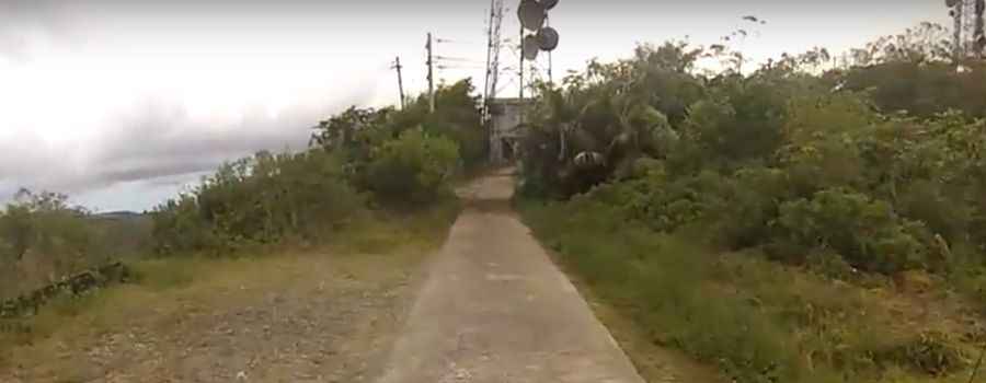
Set high in the mountainous central region of the country, the steep road to the summit, the highest peak in Puerto Rico, has a slippery slope ascending and descending. It's mostly concrete, and a 4x4 vehicle is required. Use your discretion when deciding to drive it. If it is rainy, it could be quite treacherous. Starting from Highway 143 (the Ruta Panorámica), the road to the summit is 1.0 km (0.62 miles) long. Over this distance, the elevation gain is 167 meters, and the average gradient is 16.7%.
Is the drive to Cerro de Punta in the Cordillera Central worth it?
The peak has many radio and television transmission towers, and offers some of the best views in Puerto Rico. In good weather, you can see almost the entire island, including San Juan, over 75 miles (120 km) away. There is also an observation platform at the top for visitors to enjoy the scenery.
Pic&video: Edgar Ortiz