What are the most spectacular roads in Puerto Rico?
Puerto Rico is an unincorporated territory of the United States, located in the northeastern Caribbean Sea. With mountains in the interior and sandy beaches, the territory hosts a wide range of roads.
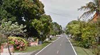
While traveling to the territory, you have to drive the scenic Panoramic Route. Locally known as Ruta Panorámica Luis Muñoz Marín, it is a very scenic drive crossing Puerto Rico from west to east through the Cordillera Central, the central mountain range. This is an adventurous road trip, ideal for confident drivers. If you prefer mountain drives, you can’t miss Cerro de Punta in the Cordillera Central, a mountain peak at 1,331m (4,366ft) above sea level, located on the boundary between Jayuya and Ponce.
Driving the scenic Panoramic Route in Puerto Rico
Ruta Panorámica Luis Muñoz Marín is a very scenic drive crossing Puerto Rico from west to east through Cordillera Central, the central mountain range. This is an adventurous road trip, ideal for confident drivers.
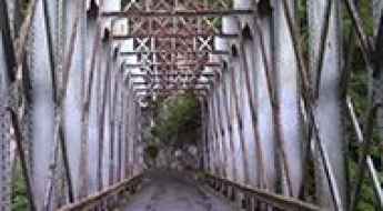
Puente Mata de Plátanos is an iconic bridge in Puerto Rico
Mata de Plátanos Bridge is an iron bridge located near Ciales, in Central Puerto Rico. It’s one of the most spectacular bridges in the world.
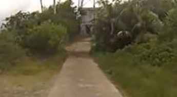
How to get by car to Cerro de Punta in the Cordillera Central?
Cerro de Punta is a mountain peak at an elevation of 1.331m (4,366ft) above sea level, located on the border between the municipalities of Jayuya and Ponce, in Puerto Rico.
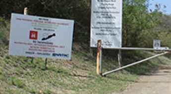
The Tropical Island Where You Must Never Step Off the Road (Vieques, Puerto Rico)
Vieques is a vibrant island municipality of Puerto Rico (U.S. Territory) known for its incredible beaches and bioluminescent bay. Yet, over half the island’s pristine eastern side is a restricted zone—the legacy of 60 years of use as a live-fire bombing range by the U.S. Navy. The island features a beautiful network of paved and dirt coastal roads, but large parts of these scenic routes are closed to public traffic because they hide a deadly secret: unexploded ordnance (UXO).