How to drive the mountain road from Honey to Xicotepec in Puebla?
The road from Honey to Xicotepec (running through Pahuatlán and Tlacuilotepec) is a steep, mountain route in the Sierra Norte region of Puebla, Mexico. Dropping dramatically from high-altitude pine forests down into deep tropical river canyons, the narrow paved road passes near massive drop-offs, indigenous villages, and the 380-meter-tall Tlacuilotepec waterfall.
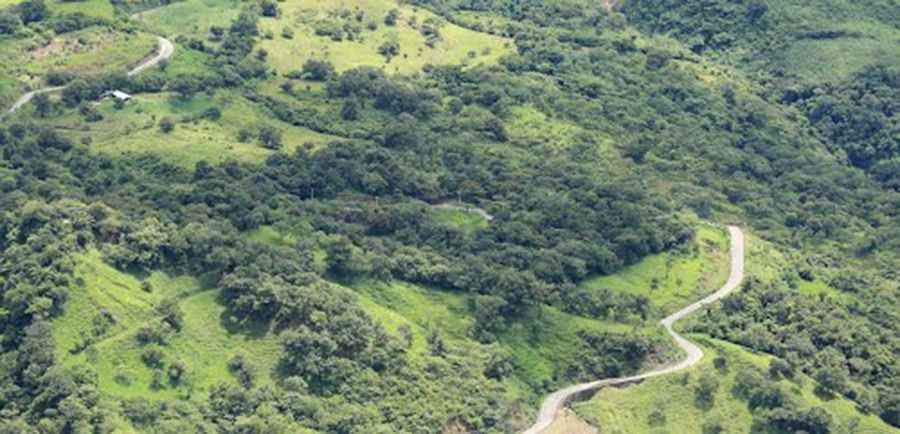
| Road facts: Honey to Xicotepec Road | |
|---|---|
| Location | Sierra Norte de Puebla, Puebla State (Mexico) |
| Starting Elevation (Honey) | 2,140 m (7,020 ft) |
| Lowest Canyon Elevation (Pahuatlán) | 720 m (2,362 ft) |
| Elevation Loss | Over 1,420 vertical meters |
| Surface | Paved asphalt |
| Key Hazards | Constant landslides, thick mountain fog, unshielded canyon drops, pedestrians on road |
Where is the Honey to Xicotepec road located?
The road traverses the rugged mountains of the Sierra Norte de Puebla in central-eastern Mexico. Starting at the high-altitude municipality of Honey at 2,140 meters, the track winds northeast through Pahuatlán and Tlacuilotepec before reaching Xicotepec de Juárez.
Is the road from Honey to Xicotepec paved?
Yes, the route is paved with asphalt. However, it is a narrow two-lane mountain road without center markings or shoulders, featuring continuous sharp blind bends cut directly into steep earth and rock slopes.
How steep is the descent from Honey to Pahuatlán?
The descent is extreme, dropping more than 1,420 vertical meters over a short distance. The road plunges from the cool ridges of Honey (2,140 m) down into the tropical canyon floor near Pahuatlán (720 m), requiring constant engine braking to avoid overheating vehicle brakes on the long downhill ramps.
What hazards exist on the Honey-Xicotepec road?
Heavy rainfall and dense mountain fog (niebla) frequently drop visibility to near zero in the high passes. Active landslides regularly dump rocks and mud onto the narrow asphalt, and drivers must watch for pedestrians walking along the roadside between small indigenous villages.
Road suggested by: Eblem Torres
Pic: panza.rayada