Tepehuacán de Guerrero Road: Driving the Sierra Madre escarpments
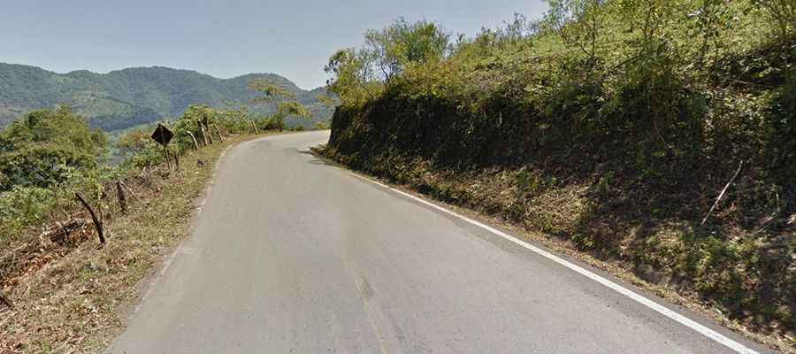
The road to Tepehuacán de Guerrero is a technical mountain route located in the heart of the Sierra Madre Oriental, in the northern part of the Hidalgo state, Mexico. This uncategorized road is defined by its constant and extreme elevation changes, crossing deep canyons and climbing steep ridges through tropical forests and high-altitude mountain terrain.
| Road facts: Tepehuacán de Guerrero Road | |
|---|---|
| Location | Hidalgo, Sierra Madre Oriental, Mexico |
| Length | ~100 km (62 miles) |
| Max Elevation | 1,560 m (5,118 ft) |
| Min Elevation | 260 m (853 ft) |
Where does the Tepehuacán de Guerrero road start?
The route begins at a T-junction with Highway Mexico 85 in Allende, at an elevation of 1,360 meters. From this point, the road enters a relentless sequence of vertical shifts. It first drops sharply into a canyon at 260 meters near Huatepango, before climbing again to the summit of Tepehuacán at 1,560 meters. This pattern repeats as the road descends once more to a river bed in Tamala (330m) and finishes at the junction with Highway Mexico 105 at 1,540 meters.
Is the road to Tepehuacán de Guerrero paved?
The road is paved, but the asphalt is narrow and lacks a center line in many sections. As seen on the ground, the surface is often worn at the edges, and there are no safety barriers between the lane and the steep drops into the canyons. The road is physically won from the mountain slopes, meaning that rockfall and debris are common after heavy rains. Overtaking is almost impossible due to the constant curves and limited visibility through the dense vegetation.
What are the hazards of the Sierra Madre Oriental transit?
The primary hazard is the extreme thermal and mechanical stress on the vehicle. Navigating several 1,000-meter climbs and descents in less than 100 kilometers will test the cooling system and the brakes. Engine braking is mandatory; if you ride the brake pedal on the long descents toward Huatepango or Tamala, you will experience brake fade before reaching the bottom. Additionally, the area is prone to thick fog and sudden tropical storms that turn the narrow asphalt into a slick trap.
How does the climate affect the Tepehuacán road?
Due to the high elevation and tropical humidity, visibility is frequently reduced to a few meters by fog (neblina). In the winter months, ice can form on the highest ridges above 1,500 meters, which is particularly dangerous on a road with so many blind corners and no guardrails. During the rainy season, landslides can block entire sections of the route, forcing long reversals on a ledge that is barely wide enough for two cars to pass each other.
Why is this road considered a high-fatigue drive?
Driving to Tepehuacán de Guerrero requires constant gear shifting and high focus. The road follows the natural topography of the Sierra Madre without the modern engineering found on major highways. This results in a bumpy, high-vibration journey where the driver must be alert for local traffic, animals, and agricultural debris in the middle of the lane. It is a slow-speed transit where mechanical self-sufficiency is the only buffer against the isolation of the Hidalgo mountains.
Road suggested by: Eblem Torres