How to drive the high-mountain ZAC 155 Road to Vetagrande in Zacatecas
The ZAC 155 is a high-altitude state highway located in the central state of Zacatecas, in Mexico. The paved road runs north of the state capital to connect the urban center with the historical mining municipality of Vetagrande, traversing a rugged semi-desert mountain terrain and reaching a maximum elevation of 2,680 meters (8,792 ft) above sea level.
| Road facts: ZAC 155 (Vetagrande Road) | |
|---|---|
| Location | Zacatecas (Mexico) |
| Max Elevation | 2,680 m (8,792 ft) |
| Min Elevation | 2,300 m (7,545 ft) |
| Surface | Paved (Variable condition asphalt) |
| Road Designation | State Road ZAC 155 |
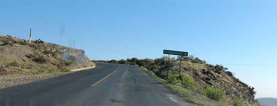
How is the asphalt condition on the ZAC 155 road?
The state road, also known along its initial mountain section as the Paseo de la Bufa, is fully paved but features an asphalt surface in a deteriorating state. Starting from the lower valley floor near Guadalupe at an altitude of 2,300 meters, the lane climbs steadily toward the high ridges. The pavement condition becomes highly irregular closer to the Vetagrande township, presenting deep cracks, broken edges, and a lack of regular maintenance.
What are the driving hazards on the ZAC 155 to Vetagrande?
The single-lane mountain road features an alignment of continuous tight corners and blind curves that lack lateral concrete barriers or steel safety guardrails. The 380-meter vertical ascent culminates at the 2,680-meter summit apex, where the track cuts through narrow stone passes with zero side shoulders. Drivers share the narrow lanes with heavy industrial vehicles and commercial cargo dump trucks linked to the active local mining extraction facilities.
What infrastructure borders the ZAC 155 mountain highway?
The active asphalted lane serves as the primary transport ridge link crossing directly between Cerro de la Bufa and Cerro del Grillo. The high-altitude alignment runs beneath a public cableway system and passes technical telecommunications towers stationed on the crest line. The roadbed follows the steep contours of the mountain slopes, forcing continuous transmission downshifts to overcome the sustained vertical grade without losing uphill traction.
Is the road to Vetagrande safe for night driving?
The ZAC 155 completely lacks public street lighting systems or reflective paint markings along the asphalted lane edges. Driving after dusk increases risks due to sudden low-visibility mountain fog blankets that settle over the 2,680-meter summit ridges. The narrow lanes offer no runoff space or emergency parking turnouts, making unmapped pavement potholes and slow-moving local traffic difficult to spot along the dark switchbacks.
Road suggested by: Eblem Torres