How to drive the coastal Mismaloya Road in Mexico?
The Mismaloya Road (Carretera a Mismaloya) is a scenic coastal section of Federal Highway 200 (Mexico 200) located south of Puerto Vallarta, in the state of Jalisco. The 11.5 km route runs along the Pacific coastline, carved into steep jungle cliffs directly above Banderas Bay.
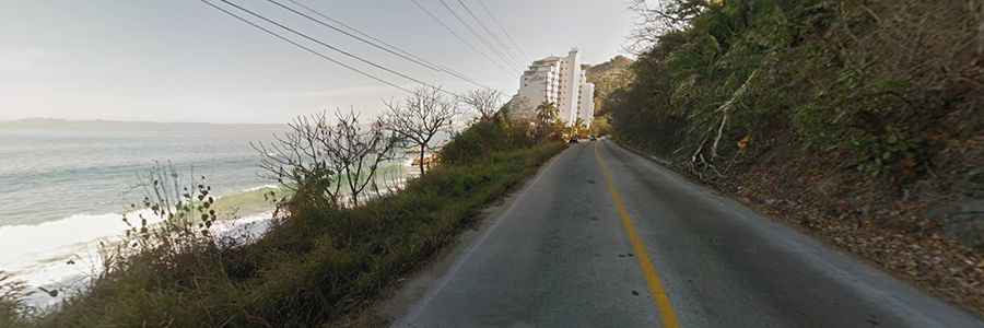
| Road facts: Mismaloya Road (Mexico 200) | |
|---|---|
| Location | Jalisco, Mexico (South of Puerto Vallarta) |
| Route Designation | Carretera Federal 200 (Cihuatlán - Puerto Vallarta) |
| Length | 11.5 km (7.1 miles) to Mismaloya |
| Surface | Paved asphalt |
| Road Width | Two lanes (one per direction), no paved shoulder |
| Key Hazards | Heavy traffic, narrow lanes, unshielded drop-offs, pedestrians near beaches |
Where is the Mismaloya Road located?
The road starts in the southern hotel zone of Puerto Vallarta and runs south along the edge of Banderas Bay toward Mismaloya and Tomatlán. It is part of the main Mexico 200 coastal highway in the state of Jalisco.
Is the Mismaloya Road paved?
Yes, the road is fully paved with asphalt. However, it is narrow, featuring tight curves squeezed between steep rock cutouts on one side and direct drops down to the ocean on the other, with almost no paved shoulder.
How busy is the drive from Puerto Vallarta to Mismaloya?
Traffic is usually heavy. The 11.5 km stretch handles local buses (camiones), delivery trucks, tour vans, and beachgoers heading to coastal access points like Los Arcos and Mismaloya beach, making passing almost impossible.
What are the main hazards on the Mismaloya Road?
The main hazards are narrow lanes without shoulders, unshielded drops off the asphalt edge, vehicles stopping suddenly near beach entrances, and heavy traffic bottlenecks during late afternoon sunset hours.
Road suggested by: Eblem Torres