Camino a Ozolotepec: Driving the High Mountain Road in Oaxaca
Camino a Ozolotepec is a high-altitude mountain road located in the Sierra Sur region of the Oaxaca state, Mexico. The unpaved route connects the remote mountain settlements of Santo Domingo Ozolotepec, San Juan Ozolotepec, and San Francisco Ozolotepec.
| Road facts: Camino a Ozolotepec | |
|---|---|
| Location | Sierra Sur, Oaxaca, Mexico |
| Max Elevation | 3,030 m (9,940 ft) |
| Min Elevation | 1,350 m (4,429 ft) at the river canyon |
| Surface | Paved (initial sector) / Unpaved Dirt & Rock |
What is the route of the Camino a Ozolotepec?
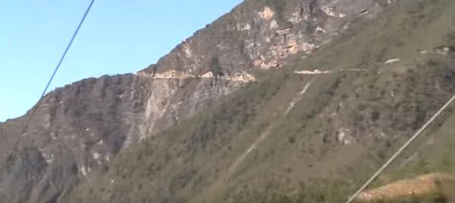
The route starts at a junction on the paved Oaxaca State Route 175 near the town of El Pacífico, at an elevation of 2,530 meters above sea level. The road climbs through San Sebastián Río Hondo up to a maximum mountain pass elevation of 3,030 meters. From this crest, the track narrows and begins a steep descent to Santo Domingo Ozolotepec (2,330m), drops further to San Juan Ozolotepec (2,100m), ascends a secondary ridge at 2,780 meters, and goes down to San Francisco Ozolotepec (1,990m). The track ends abruptly at a river canyon floor at 1,350 meters altitude.
Is the Camino a Ozolotepec paved?
Only the opening section leading through San Sebastián Río Hondo is paved with asphalt. The remaining mountain route is entirely unpaved, consisting of a single-lane track of loose dirt, broken shale, and exposed bedrock layers. The sector between Santo Domingo and San Juan is a shelf road cut into the canyon walls, where the clearance is narrow enough to prevent two vehicles from passing each other simultaneously. Near San Francisco, the track features steep, unbanked switchbacks that lead down to the riverbed.
What are the physical hazards on the Camino a Ozolotepec?
The road runs through a high-seismicity zone in the Sierra Sur range. Ground tremors cause recurrent mudslides, structural fissures on the dirt track, and rockfalls that deposit boulders across the lanes. The single-lane layout runs through narrow village streets where houses flank the dirt shoulder directly, leaving zero clearance for evasive maneuvers in case of mechanical brake failures on descending trucks.
Where does the Camino a Ozolotepec end?
The drivable track terminates at the river bottom at 1,350 meters altitude. An unpaved extension is under construction to connect the route with San Felipe Lachilo (960m) to establish a link toward the Pacific coast. The road alignment passes near Cerro Nube Flon, the highest mountain peak in Oaxaca state at 3,750 meters above sea level, which is structurally accessed via the nearby town of Santiago Lapaguia.
Road suggested by: Eblem Torres
Pic: pasadoolvido