How difficult is the unpaved road of Caminos del Cobre in Zacatecas?
Caminos del Cobre is a high-altitude mountain track located in the northern part of Zacatecas state, Mexico. Connecting the mining towns of Salaverna and Concepción del Oro, this rugged dirt and rocky road is one of the most remote journeys in the region. Reaching a peak of 2,820m (9,252ft) above sea level at Cerro Aranzazu, the route is a test of vehicle durability, where the desert heat and the sharp, unmaintained stones of the track can easily end a trip for those unprepared for the harsh mining landscape.
| Road facts: Caminos del Cobre | |
|---|---|
| Location | Zacatecas State, Mexico |
| Elevation | 2,820m (9,252ft) |
| Length | 14 km (8.7 miles) |
| Surface | Unpaved / Loose Rocks / Dirt |
| Vehicle Required | High-clearance 4x4 |
How long is the road between Salaverna and Concepción del Oro?
The road spans 14 km (8.7 miles) through a desolate mountainous landscape. While the distance is short, the terrain makes for a slow, grueling drive that can take over an hour to complete. The track follows the contours of the jagged ridges near the Cerro Aranzazu mine, where the road surface has been hardened by decades of mining activity but remains unpaved. This stretch is a key part of the network of mountain roads in mining zones, where the ground is often composed of loose tailings and sharp shale that can cut through a tire sidewall in seconds.
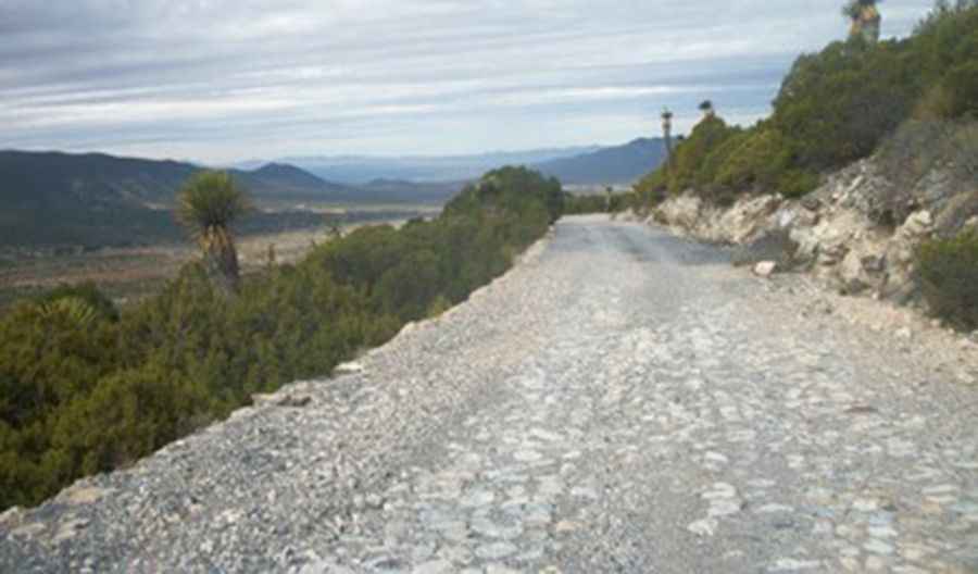
What are the road conditions on Caminos del Cobre?
As seen on the ground, the surface is a punishing mix of loose gravel and embedded boulders. The road is constantly exposed to the intense Zacatecan sun, which dries out the dirt and turns it into a fine powder that hides deep ruts and sharp rocks. There are no guardrails along the steep drops that overlook the surrounding valleys and abandoned mining ruins. A high-clearance 4x4 is not just recommended; it is mandatory to clear the high centers of the track and to maintain traction on the loose climbs where the tires tend to spin on the dry, dusty stones.
Why is Cerro Aranzazu a hazard for drivers?
Topping out at 2,820m, the section near Cerro Aranzazu is the highest and most dangerous part of the trip. The elevation causes a noticeable drop in engine power, which can be a problem on the steeper ramps where constant torque is required to keep the vehicle moving forward over the loose stones. This area is also prone to sudden dust storms that can reduce visibility to zero in a matter of seconds. Driving here requires a vehicle with a solid suspension and tires designed for off-road use, as the "Caminos del Cobre" are littered with debris from old mines that can cause mechanical failure far from any help.
Is it safe to drive Caminos del Cobre during the rainy season?
The rainy season turns Caminos del Cobre into a death trap. The dry, dusty soil of Zacatecas has poor drainage, meaning that even a short thunderstorm can cause flash floods that wash away entire sections of the 14 km track. The loose stones become slippery, and the deep ruts fill with mud, making it impossible to judge the depth of the holes. During these months, the risk of rockfalls from the cliffs near the abandoned churches and mines increases significantly. It is best to avoid this route after any significant rain, as the soft edges of the track can easily give way under the weight of a 4x4, leading to a slide into the valley below.
Pic: ANTOAN TONI
Road suggested by: Eblem Torres