Cuesta del Cajón: Driving the scenic road through Chihuahua's pine forests
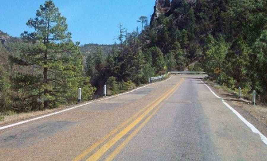
Cuesta del Cajón is a demanding mountain passage carved into the Sierra Madre Occidental in Chihuahua, Mexico. Known for its dense pine forests and deep rocky canyons, this section of State Route 11 is much more than a scenic drive; it is a technical challenge that tests a vehicle's braking system and a driver's precision. The route serves as a vital but treacherous link through the rugged terrain, where the natural beauty of the landscape is matched only by the concentration required to stay on the road.
| Road facts: Cuesta del Cajón | |
|---|---|
| Location | Chihuahua, Mexico (Route 11) |
| Length | 42.9 km (26.6 miles) |
| Hairpin Turns | 20 tight switchbacks |
| Hazard Level | Moderate-High (Steep grades & rockfall) |
How long is the road to Cuesta del Cajón?
This segment of Chihuahua State Route 11 stretches for 42.9 kilometers (26.6 miles), connecting the settlements of Babícora and El Largo in a south-north direction. Do not be fooled by the distance; this is not a route to be rushed. The layout consists of a relentless series of steep climbs and descents through the heart of the mountain range. The road hugs the edges of rocky canyons, forcing drivers to maintain a low and steady speed to ensure safety.
Travel logistics require careful planning, as service stations and fuel stops are non-existent once you enter the thicker parts of the forest. It is essential to inspect your braking system before departure, as the sustained gradients put immense pressure on the vehicle. On the steep descents toward the canyon floors, using engine braking is mandatory to prevent brake fading or overheating the pads.
Is it difficult driving through Cuesta del Cajón Road?
Driving in this sector is both technical and demanding. The critical points are the 20 hairpin turns that must be navigated with absolute precision. Many of these switchbacks are so tight that long vehicles or trucks may struggle to clear them, especially if there is oncoming traffic. The pavement condition is variable; erosion and the pressure of pine roots often heave the surface, creating sudden potholes in blind spots.
One of the most persistent dangers is the encroaching vegetation. Pine trees and thick brush grow aggressively along the shoulders, and without recent maintenance, they can scratch vehicle bodywork or severely limit visibility on sharp corners. Furthermore, in the canyon sections, small rockfalls and gravel are common, making the pavement treacherous and slippery even in dry conditions. If you are driving a 4x4, the extra traction will be a significant advantage when pulling out of the steepest corners.
What are the main hazards on Cuesta del Cajón Road?
Beyond the twisting path, real hazards include steep drops without solid guardrails and the constant presence of local livestock or wildlife. If you plan to detour toward Cascada el Salto or the archaeological site of Cuarenta Casas, be aware that secondary access roads are often unpaved tracks where a high-clearance 4x4 vehicle is practically indispensable. In these sections, utilizing the low-range gears (reductora) will help you negotiate steep ramps without compromising control.
How is the weather affecting Cuesta del Cajón Road?
The climate in the Chihuahua highlands is extreme and unpredictable. During winter, the area is prone to severe frosts and snowfalls that can close the road for hours or even days. Black ice on the asphalt, particularly in shaded sections that never see direct sunlight, turns Cuesta del Cajón into a dangerous skating rink. During the summer rainy season, the primary risk shifts to landslides and mudflows that can completely block lanes with debris from the slopes above.
Road suggested by: Eblem Torres
Pic: Manuel L.Hernandez