The road to Cofre de Perote in Veracruz isn’t an easy one
Cofre de Perote is an extinct volcano at an elevation of 4,160 m (13,648 ft) above sea level, located in the Mexican state of Veracruz. It’s one of the highest roads in the country.
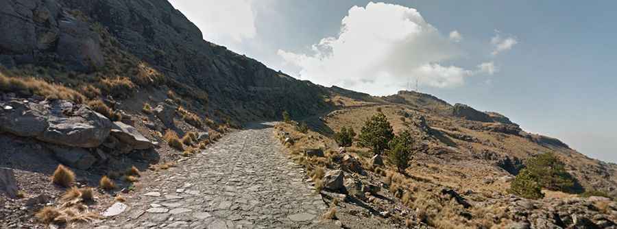
Is the road to Cofre de Perote unpaved?
Located within the Cofre de Perote National Park, the winding road to the summit, sometimes also called Nauhcampatépetl, is totally unpaved and narrow, so proceed cautiously and hope no other vehicles come from the other direction. Not recommended if you don't know how to reverse. The summit hosts many communication facilities and towers.
When is the best time to drive to Cofre de Perote?
Expect snow near the summit during winter months. During the rainy season, roughly July to October, there is a bigger chance for rain.
How long is the road to Cofre de Perote?
The road to the summit is pretty steep and features countless hairpin turns. Starting from Perote, the ascent is 9.6 km (5.96 miles) long. Over this distance the elevation gain is 906 meters and the average gradient is 9.43%.
Road suggested by: Eblem Torres