The horrendous road to Nevado de Colima
Nevado de Colima is a high mountain peak at an elevation of 3.991m (13,093ft) above sea level located in the Mexican state of Jalisco. The road to the summit is horrendous with sections up to 12%. 4x4 is the only option. It's one of the highest roads of the country.
How challenging is the road to Nevado de Colima?
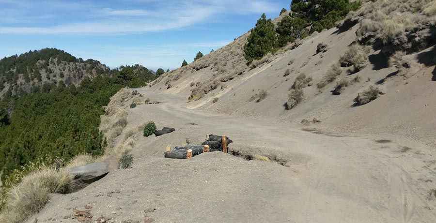
The road to the summit is difficult, with gradients up to 12%. Only robust 4x4 vehicles can handle this terrain. As you climb, the road narrows and resembles a mule track in some parts. It is about one and a half lanes wide and can become muddy and slippery after rain, making it a challenge even for experienced drivers.
Is the road to Nevado de Colima unpaved?
Yes, the route is mainly gravel and rock, located within Nevado de Colima National Park. Due to its difficulty, tourists can only go up to a locked gate at around 11,500 feet.
Why was the road to Nevado de Colima built?
The road was originally constructed to provide access to communication towers at the summit, necessitating high-clearance or 4WD vehicles for the trip.
How long is the road to Nevado de Colima?
Located on the western part of the country, the road starts at Carretera Estatal el Grullo-Ciudad Guzman and extends for 23.4 km (14.54 miles), with an elevation gain of 2,214 meters. The average gradient is 9.46%, with some sections reaching 12%.
Road suggested by: Eblem Torres
Pic: Elmo Villaseñor