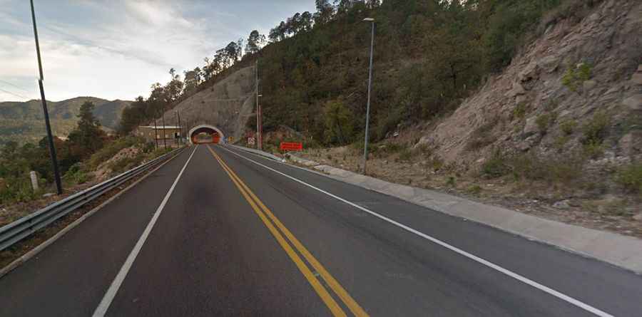
Durango-Mazatlan Highway: the road with 115 bridges and 61 tunnels
Mexico 40D is an amazing journey in the western Sierra Madre of Mexico. Also known as the Autopista Durango-Mazatlán, it’s one of Mexico’s greatest engineering feats, with 115 bridges and 61 tunnels.
How long is the Durango-Mazatlan Highway?
The road is 211km (131 miles) long and bypasses the infamous Espinazo del Diablo, a road stretching along the spine of a mountain with drops of hundreds of feet on either side. The road is impressive due to its natural landscapes (tropical, pine forest, desert) and engineering marvel. The road links Durango, the capital and largest city of the Mexican state of Durango at an elevation of 1,880 meters (6,168 feet) above sea level, and Mazatlán, a resort town along the Pacific shoreline in the state of Sinaloa.
Is the Durango-Mazatlan Highway challenging?
The road is fully paved. Landslides, potholes, blocked tunnels, and asphalt that is in poor condition are among the problems besetting the 211-kilometer-long highway.
When was the Durango-Mazatlan Highway built?
Opened in October 2013, the highest part of the road is near 9,000 feet, so during the winter months, there is the added danger of ice and it can be closed anytime due to snowfalls.
What’s Tunel el Sinaloense?
The road features 115 bridges and 61 tunnels. The longest tunnel is called Tunel el Sinaloense. It spans 9183 feet long (1.7 miles). The most spectacular part of the drive is the Baluarte Bridge (Puente Baluarte). It’s the highest cable-stayed bridge in the world, the third-highest bridge overall, and the highest bridge in the Americas. It’s a record-breaking 1,124 meters in length, 20 meters in width, and its height above the canyon is 403 meters.
Road suggested by: Eblem Torres.