An epic enthralling road to Cortes Pass
Paso de Cortés is a high mountain pass at an elevation of 3.692m (12,112ft) above sea level located on the boundary between Puebla and the State of Mexico, in Mexico. It’s one of the highest roads in the country.
Where is Cortes Pass in Mexico?
Set high in the Izta-Popo Zoquiapan National Park, the pass is located between the Popocatépetl and Ixtaccíhuatl volcanoes, to the southeast of Mexico City.
How long is Cortes Pass in Mexico?
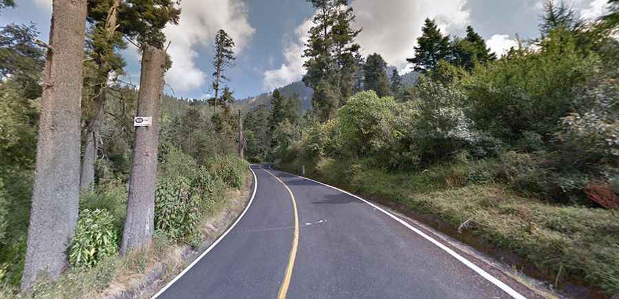
The road to the summit, also known as Tlamacaxco, is totally paved. It’s a twisty uphill road, very steep, with lots of trees. The pass is 43.7 km (27.15 miles) long, running west-east from Amecameca de Juárez (in Mexico State) to San Nicolás de Los Ranchos (in Puebla).
How long does it take to drive Cortes Pass?
To drive the road without stopping will take most people between 1.5 and 2 hours. At the summit, there’s a big parking lot, a bar, and an information center. It’s the starting point of the climb to Estación de Altura Altzomoni, a high-altitude weather station at an elevation of 3,985m (13,074ft) above sea level.