Take An Unforgettable Drive to Sierra Negra volcano in Mexico
Sierra Negra is an extinct volcano, standing at an elevation of 4,576m (15,013ft) above sea level, located in the Mexican state of Puebla. It’s one of the highest roads in the country.
Where is Sierra Negra?
The volcano, also known as Cerro La Negra, is situated close to the border with Veracruz state, in the highlands of south-central Mexico, within the Pico de Orizaba National Park.
Why is Sierra Negra famous?
The summit hosts the Large Millimeter Telescope, the world's largest single-dish steerable millimeter-wavelength telescope designed specifically for astronomical observations in the wavelength range of 0.85 – 4mm.
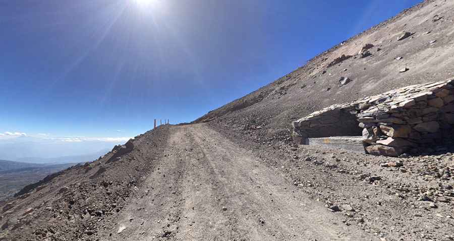
Is the road to Sierra Negra unpaved?
The road to the summit, also known as Tliltépetl or Volcán Atlitzin, is entirely unpaved and very rough in many places. A 4x4 vehicle is required. The road is extremely curvy and winding, making it one of the most hairpinned roads in the world.
How long is the road to Sierra Negra?
The road to the summit is very steep, with some ramps hitting a 17% maximum gradient. Starting at Atzitzintla, the ascent covers 18.5 km (11.49 miles), with an elevation gain of 1,849 meters. The average gradient is 9.99%.
Is the road to Sierra Negra open?
Keep in mind that this is a mountainous area, ascending to a high mountain, with a notorious absence of oxygen. Altitude and extreme weather are always factors to consider. It ranks as one of the highest roads in North America. The road to Sierra Negra's summit is closed to private vehicles; special permission is required for access.
Pic: jean gamboa