How to drive to Nevado de Toluca in Mexico?
Nevado de Toluca is a towering, inactive stratovolcano located in Estado de México. A road near the summit tops out at 4.254m (13,956ft) above sea level. It’s one of the highest roads of the country.
Where is Nevado de Toluca?
The volcano is located in the central part of the country, only a few hours from Mexico City.
Can you drive to Nevado de Toluca in Mexico?
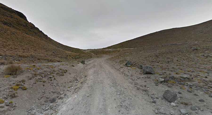
Set high in the Parque Nacional Nevado de Toluca (Nevado de Toluca National Park), the road to the summit (also known as Xinantécatl) is totally unpaved, in poor condition due to the rainfalls and volcanic rocks. A unique feature of this volcano is that one can drive almost to the crater. However, it’s no longer permitted to drive to the crater, being gated 2 km before the lakes. To access the volcano's crater, one has to pass a couple of checkpoints where an access fee has to be paid. If you are going during the winter, the upper parking lot may be closed and you may have to park lower.
How long is the road to Nevado de Toluca in Mexico?
The road to the volcano is 20.5 km (12.73 miles) long, starting at Raíces, a village in the Municipio of Zinacantepec. The road is passable by 2-wheel drive cars in dry weather. The road to México's fourth highest peak is steep in parts, hitting a 7% of maximum gradient through some of the ramps. Starting at Raíces, the elevation gain is 784 meters. The average gradient is 3.82%.
How long does it take to drive the road to Nevado de Toluca in Mexico?
To drive the road without stopping will take most people between 1.5 and 2 hours. The journey is very picturesque, amidst dense pine forests with the view of the snow capped volcano approaching nearer every turn. A number of lodging sites are passed along the way. Six kilometers from the crater, there’s a gate, café and basic refugio (rustic shelter).
Can I drive the road to Nevado de Toluca in winters?
From November to March, the summit region often experiences snowfall, creating favorable conditions for off-piste cross-country skiing. However, during the most severe snowstorms, Parque Nacional Nevado de Toluca is closed for safety reasons.