What are the most spectacular roads in Greenland?
Greenland, the world's largest island, is an autonomous territory within the Kingdom of Denmark, located in the North Atlantic and Arctic Oceans. Geographically, it is part of the North American continent. The land area of Greenland is approximately 2,166,086 square kilometers, 79% of which is covered by the Greenland Ice Sheet.
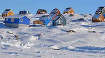
Due to its vast ice sheet, extensive fjords, and rugged, mountainous terrain, Greenland has a unique and highly limited road network. There are no inter-settlement roads connecting towns and villages. The total length of roads across the entire country is estimated to be around 150 kilometers (approximately 93 miles), with only about 60 kilometers (37 miles) of these being paved. These roads exist exclusively within the boundaries of individual settlements, providing local transportation.
Notable road segments include the internal networks of the capital, Nuuk, and other major towns such as Sisimiut and Ilulissat. Greenland's only paved road is a 4.5 km (2.8 mi) stretch in the southwestern part of the country, connecting Ivittuut (an abandoned mining town) to Kangilinnguit (a former naval base location). This road is often impassable in winter due to snow. Additionally, a unique 4x4 track, approximately 170 kilometers (106 miles) long, connects Sisimiut and Kangerlussuaq, built for off-road vehicles.It's the Longest Road in Greenland. Traditional and primary modes of inter-settlement transport are by air (flights) and sea (ferries and boats).
Drivers must be aware of the Arctic climate, which features long, cold winters and short, cool summers. Conditions can change rapidly, with snow, ice, and strong winds frequently affecting road usability within the settlements.
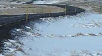
Why Greenland Has Only One Paved Road? A Drive from Ivittuut to Kangilinnguit
Located between the Arctic and Atlantic Oceans, east of the Canadian Arctic Archipelago, Greenland is the world's largest island. Due to the country's landscape, with mountains, fjords, and glaciers, there are no roads between settlements on the entire island, only within and around them.
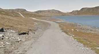
The Ice Sheet Road in Greenland: Driving to the Edge of the World's Ice Sheet
The Ice Sheet Road is located in western Greenland, in the Qeqqata municipality. It runs northeast from Kangerlussuaq to the vast Greenland Ice Sheet, a world-class attraction and one of the island's most prominent landscape features.
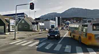
Do You Know How Many Traffic Lights There Are in All of Greenland?
Greenland is a fascinating country. Located between the Arctic and Atlantic Oceans, east of Canada, it is the largest island in the world with Nuuk as its capital. Below, we’ve gathered the main curiosities about Greenland.
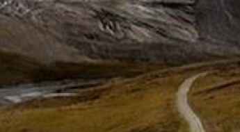
Driving the Longest Road in Greenland: The Arctic Circle Road from Sisimiut to Kangerlussuaq
The Arctic Circle Road is situated in western Greenland, connecting the inland town of Kangerlussuaq to the coastal town of Sisimiut. This track represents a significant infrastructure development in one of the world's most challenging and sparsely populated environments.
Top Adventure Activities in Greenland: Hiking, Kayaking, and More
Greenland is a land of raw beauty and endless adventure. With vast glaciers, towering mountains, deep fjords, and remote Arctic wilderness, it offers some of the most thrilling outdoor experiences in the world.