Powderface Trail Road in Alberta: Navigating Kananaskis Country's Scenic Challenge
The Powderface Trail offers a captivating journey amidst the scenic front ranges of Kananaskis Country, right in the heart of Alberta, Canada. This magnificent drive demands profound respect from its travelers.
How Long is the Powderface Trail?
Stretching 34 km (21 miles), this road runs north-south, connecting Highway 68 (Sibbald Creek Trail) to AB-66. As it winds its way through the secluded landscapes of Kananaskis Country, the trail flanks creeks and dense coniferous forests. While suitable for most vehicles, some parts of the road are narrow and steep.
How Dangerous is the Powderface Trail?
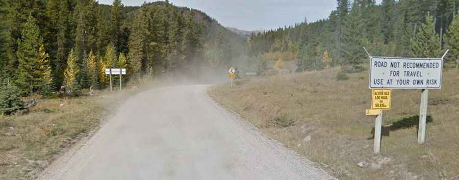
A sign at the trail's onset cautions: ‘Road not recommended for travel. Use at your own risk’. With its series of twists and turns, this well-maintained gravel road resembles a roller coaster ride. Some portions of this challenging route occasionally erode. Given the absence of cell phone reception, travelers should come prepared. The trail, especially vulnerable to strong winds, is no ordinary drive. It demands specific driving skills due to its loose gravel, uneven terrain, and dust. And a word to the wise: always be on the lookout for livestock.
Is the Powderface Trail Always Open?
Set high within the Rocky Mountains, travelers should tread cautiously on this mountainous route that tops out ar 1,854m (6,082ft) above sea level. It remains closed from December 1st to May 15th, depending on weather conditions.