Travel guide to the top of North Fork Pass Summit in Yukon
North Fork Pass Summit is a mountain pass at an elevation of 1.328m (4,356ft) above sea level, located in Yukon, in Canada.
Where is North Fork Pass Summit?
The pass is located in the northwestern part of the country, not far from the Alaska border, in the Tombstone Territorial Park. The pass marks the Continental Divide between the Yukon and Mackenzie River systems.
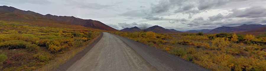
Is North Fork Pass Summit unpaved?
The road to the summit is totally unpaved. It’s called Dempster Highway. It’s a well-maintained gravel and crushed stone road. Appropriate preparation is essential. Facilities are few and far between.
How long is North Fork Pass Summit?
The road is 736 km (457 mi) long, running south-north from the Klondike Highway (east of Dawson City in Yukon) to Inuvik (in Northwest Territories on the Mackenzie River delta).
Is North Fork Pass Summit open?
At this elevation, it’s the highest point on the Dempster Highway. The pass is open approximately from June 10 to October 14 in the summer, and December 15 to April 30 in the winter.