Mount Saint Thomas: The unpaved mountain road in the Monashees
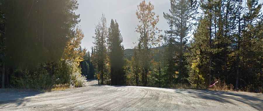
Mount Saint Thomas is a high-altitude peak at an elevation of 1,855 meters (6,085 ft) above sea level, located in the Monashee Mountains of British Columbia, Canada. The road to the summit is a totally unpaved mountain track that requires a high-clearance 4x4 vehicle to navigate the physical reality of the Selkirk-Monashee wilderness. Starting near the Blueberry-Paulson Summit on the Crowsnest Highway, the route is a technical journey through a landscape where the ground is often saturated with moisture and the isolation from any logistical support is absolute.
| Road facts: Mount Saint Thomas | |
|---|---|
| Location | Monashee Mountains, BC, Canada |
| Elevation | 1,855m (6,085ft) |
| Length | 13.2 km (8.2 miles) |
| Elevation Gain | 248 meters |
How challenging is the 13km track to Mount Saint Thomas?
While the 13.2-kilometer ascent has a moderate elevation gain of 248 meters, the logistics of the drive are far from simple. The unpaved surface is a mix of loose gravel, deep ruts, and sections where the mountain's natural drainage washes across the road. This creates soft spots where even a 4x4 can lose momentum and get bogged down if the tire pressures are not managed correctly. The physical reality of the Monashees involves navigating around fallen trees and rock debris that frequently narrow the driving line, forcing the driver to maintain constant focus on the steering rack and the undercarriage clearance.
What are the main hazards on the Monashee mountain road?
The primary hazard at Mount Saint Thomas is the extreme isolation and the lack of any safety infrastructure. There are no barriers, and the road surface is often slick with mud long after the snow has melted. The weather at 1,855 meters is highly unpredictable; sudden mountain storms can turn the unpaved floor into a slippery trap in minutes. Furthermore, the route is a high-risk sector for encounters with wildlife and natural blockages. Because the road is not a priority for maintenance, a single landslide or a heavy washout can make the 13km transit a dead-end mission, requiring high-precision reversing maneuvers on a narrow ledge.
Is the road to Mount Saint Thomas accessible year-round?
No. Due to its elevation and its location in a high-precipitation zone of British Columbia, the road is buried under heavy snow for most of the year. Accessibility is strictly limited to the summer months, typically from July to September. Even during the open window, the track can be treacherous during and after rain. The logistics of the Blueberry-Paulson area mean that help is far away; a simple mechanical failure like a puncture from a sharp rock or a snapped belt can quickly escalate into a survival situation if you are not properly equipped for the sub-alpine environment.
What mechanical prep is needed for the 1,855m BC crossing?
Before heading out from the Crowsnest Highway, verify that your 4WD system and low-range gears are fully functional. Check your tires; the sharp rocks and abrasive surface of the Mount Saint Thomas road require reinforced sidewalls. Ensure your cooling system is in perfect order, as the slow-speed crawl through the 13km track will stress the motor even on moderate inclines. Carry a full-sized spare tire, a high-lift jack, and recovery boards (Maxtrax). It is mandatory to carry extra fuel and a satellite communication device, as cellular signals are non-existent in the deep Monashee Range. In the Canadian sub-alpine, your vehicle's reliability is your only safety net.