Road Trip Guide: Conquering Mount Edith Cavell
Mount Edith Cavell is a high mountain peak at an elevation of 1,767m (5,797ft) above sea level, located in the Alberta province of Canada.
Why is it Called Mount Edith Cavell?
Tucked away in the western part of the country, the mountain was named in 1916 for Edith Cavell, an English nurse executed by the Germans during World War I.
How Long is the Road to Mount Edith Cavell?
The road to a parking lot on the way to Mount Edith Cavell is 14 km (8.7 mi) long, starting at the old parkway (Highway 93A), built in the 1930s. It’s fully paved and called Cavell Road.
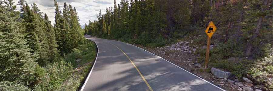
How Challenging is the Road to Mount Edith Cavell?
Nestled within Jasper National Park, the road is steep in parts, with a maximum gradient of 12% on some of the ramps. The elevation gain is 551 meters and the average gradient is 3.93%. The road is narrow and winding, with tight switchbacks that are unsuitable for trailers (there is a drop-off area at the start) and large motorhomes (longer than 7m).
Is the Road to Mount Edith Cavell Open?
Set high in the Canadian Rockies, this beautiful road is usually closed during the winter, from mid-October to mid-June.
How Long Does it Take to Drive the Road to Mount Edith Cavell?
Running through sub-alpine forests with stunning scenery, plan for about 30 minutes to complete the drive to the parking lot without any stops.