Driving the scenic Stewart-Cassiar Highway in British Columbia
The Stewart-Cassiar Highway (Highway 37) is a very scenic journey through some of the province's most isolated areas, in the Canadian province of British Columbia.
How long is the Stewart-Cassiar Highway?
The road is 874 km (543 mi) long. It runs south-north from Kitimat to Upper Liard (on the Alaska Highway).
Is the Stewart-Cassiar Highway difficult to drive?
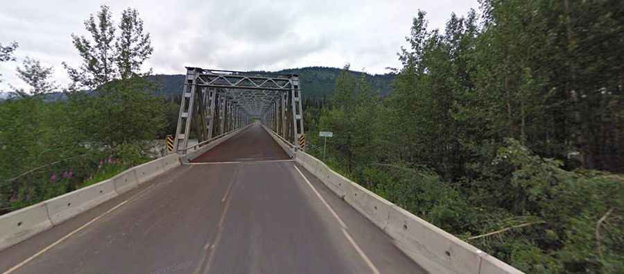
It was built in 1975. Most of the route is hard surface with approximately one kilometre of gravel. The northern half of the highway is a narrow road paved with sealcoat, not asphalt. There are a few 8 percent grades and 2 switchback turns. Be prepared to drive slowly to avoid ruining your vehicle and any vehicle hit by your flying gravel. The road is pretty basic. Some parts have no guardrails, no lane markings, no reflectors, and there is loose gravel on top of the surface. You'll encounter about three bridges that are only one lane. It’s generally narrower than most 2-lane highways, with little or no shoulder.
Is the Stewart-Cassiar Highway open in winter?
Open all year round, the road also known as Dease Lake Highway, Stikine Highway and Terrace–Kitimat Highway, it is the most northwestern highway in British Columbia.
How remote is the Stewart-Cassiar Highway?
The road runs through remote areas and some of the wildest scenery in North America, with hardly anyone for miles at a time. It is often considered the more rugged alternative to the more popular Alaska Highway. There is zero cell phone service along this route. Pay attention, the drive features outstanding scenery and good wildlife viewing. The drive offers really stunning mountainous scenery that goes on forever.