A Steep Unpaved Road to Shunda Mountain in Alberta
Shunda Mountain is a high mountain peak at an elevation of 2,066 m (6,778 ft) above sea level, located in the province of Alberta, in Canada. It's one of the highest roads in the country.
Where is Shunda Mountain?
The peak is located in the west-central part of Alberta. The summit is crowned with numerous antennas and a fire lookout.
Why is it Called Shunda Mountain?
The mountain takes its name from Shunda Creek. "Shunda" is a native word meaning "mire," which described a ford across the creek.
Is the Road to Shunda Mountain Unpaved?
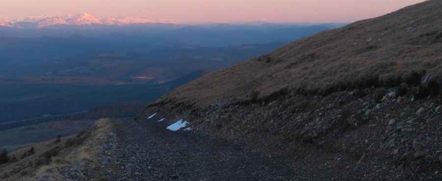
The road to the summit is completely unpaved, rough, and rocky. It’s called Baldy Mountain Road. There are some rocky, challenging sections with steep drop-offs to the side, so you need to have some driving experience.
How Long is the Road to Shunda Mountain?
The road is 10.1 km (6.27 miles) long, starting from David Thompson Highway. Over this distance, the elevation gain is 745 meters, with an average gradient of 7.37%.
Is the Road to Shunda Mountain Open in Winter?
Set high in the Canadian Rockies, the road to the summit is not plowed in winter. A gate closes access to the summit during the rest of the year.
Is Shunda Mountain Worth the Drive?
The lookout on the summit offers a 360-degree panorama of the east side of the Rockies, Coliseum Mountain, Abraham Lake, and panoramic views of Nordegg and the surrounding Front Ranges.
Pic: Ronald Cattaruzza