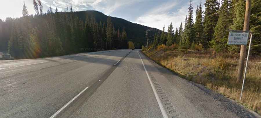
A steep paved road to Allison Pass in BC
Allison Pass is a mountain pass at an elevation of 1,350m (4,429ft) above sea level, located in British Columbia, Canada.
Where is Allison Pass?
The pass is located in the middle of Manning Park, in the Cascade Mountains of southern British Columbia, in the southwestern part of the country.
Why is it called Allison Pass?
The summit was named after John Fall Allison, a rancher living in Princeton.
Is Allison Pass in British Columbia paved?
The road to the summit is fully paved. It’s called BC-3 (Crowsnest Highway). This part of the road is known as Hope-Princeton Highway, and the pass is its highest point.
How long is Allison Pass?
The pass is 126 km (78 miles) long, running west-east from Hope (at the confluence of the Fraser and Coquihalla rivers) to Princeton (in the Similkameen region of southern British Columbia).
Is Allison Pass in British Columbia challenging?
The pass is typically open all year round, but short-term closures are common in winter due to dangerous weather conditions. Cyclists and motorists alike find this stretch of road challenging because of the steep grades and high altitudes. On the way from Hope to Allison Pass, one must ascend the 7% (1 in 14) grades up to the Hope Slide before one can start up to Allison Pass, leaving many trucks waiting at the side of the road for their engines to cool down.