Driving the scenic Klondike Highway from Alaska to the Yukon
Klondike Highway is a very scenic yet challenging drive linking the Alaskan coastal town of Skagway with Yukon's Dawson City, the heart of the Klondike.
When was the Klondike Highway built?
It was opened to traffic in 1979. For much of its length, the road generally follows the Gold Rush Trail, the route used by prospectors in the 1898 Klondike Gold Rush.
Is the Klondike Highway paved?
The road is totally paved. The journey is divided into two sections: the South Klondike Highway (from Skagway to Whitehorse) and the North Klondike Highway (from Whitehorse to Dawson City).
Where does the Klondike Highway start and end?
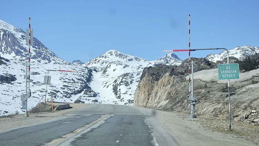
The road is 708km (440 miles) long running south-north from the coastal town of Skagway in southeast Alaska to Dawson City, on the Yukon River in the Yukon, in the northwestern part of Canada. The route comprises the Alaska Route 98 (USA) and Yukon Highway 2 (in Canada). It is the primary transportation link between Southeast Alaska and Canada and along the way you’ll find large trucks hauling various commodities.
Is Klondike Highway challenging?
The drive is pretty challenging due its remoteness and the weather. It has very steep parts, hitting an 11% of maximum gradient through some of the ramps. The road tops out at 1.010m (3,313ft) above sea level by White Pass, near the Alaska/Canada border. It’s usually open all year round.
How long does it take to drive Klondike Highway?
To drive the road without stopping will take most people between 8.5 and 10 hours. The drive runs through a stunning alpine scenery and peaks that are covered with snow all year long. Along the way -where you can feel like you are the only person alive- you’ll see unique landscapes, beautiful lakes, even some old mining structures.
Pic: Olivier Forbes-Bouillon