Road trip guide: Conquering the Haines Highway
Haines Highway is one of the most spectacular drives in North America. This scenic drive running from Alaska in the United States to Yukon in Canada is truly awesome when you travel it in the fall.
How long is the Haines Highway?
The road, also known as Haines Cut-Off or simply Haines Road, is totally paved. It’s 152 mi (245 km) long and links Haines (in Haines Borough, Alaska, United States), with Haines Junction, (a village in Yukon, Canada). It essentially follows the trail used by the Chilkat/Tinglit First Nations.
Is the Haines Highway open?
The highway, open year-round and usually snow-free by May, is a good, 2-lane paved highway. Although the highway is maintained year-round if you plan on traveling the route between September 15 and June 1, be sure to check weather conditions before you head out.
When was the Haines Highway built?
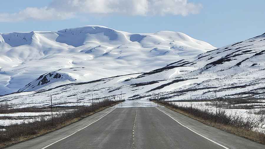
The truly fabulous highway was built by the U.S. Army in 1943 and follows the Chilkat River for more than 20 miles north of Haines. It tops out at 1.012m (3,320ft) above sea level. This route is noted for its grand views of glaciated mountains. The drive encompasses high peaks, glaciers, rivers and lakes all along the way. Noted for its grand views of glaciated mountains and the variety of its scenery—from coastal forests to alpine tundra—the Haines Highway winds through the Chilkat River flats outside Haines before beginning a long climb up to the summit, where it meanders through a wide alpine valley before descending to Haines Junction via a series of long, easy grades. No services are offered along this stretch of road, so make sure you have enough gas and supplies.
Pic: Olivier Forbes-Bouillon