Driving the treacherously steep Bella Coola Road in British Columbia
Bella Coola Road is a 454-kilometer drive in British Columbia, Canada, linking Bella Coola and Williams Lake. Known for its steep grades, this scenic route takes you through diverse landscapes, from desert canyons near the Fraser River to glaciated peaks.
How long is Bella Coola Road?
Bella Coola Road (Highway 20) spans 454 km (282 miles), running east-west from Williams Lake in the Central Interior of British Columbia to Bella Coola in the Bella Coola Valley. It's an amazingly scenic trip, but be prepared for gravel roads and steep grades. Also known as the Chilcotin Highway, it links the Central Coast with the Central Interior, crossing the Coast Mountains and the Chilcotin Plateau. Highway 20 traverses a rugged land of lakes and mountains, leading adventurous drivers from Williams Lake and the desert canyons of the Fraser River to glaciated peaks and finally to the shores of a narrow ocean fjord.
Is Bella Coola Highway 20 paved?
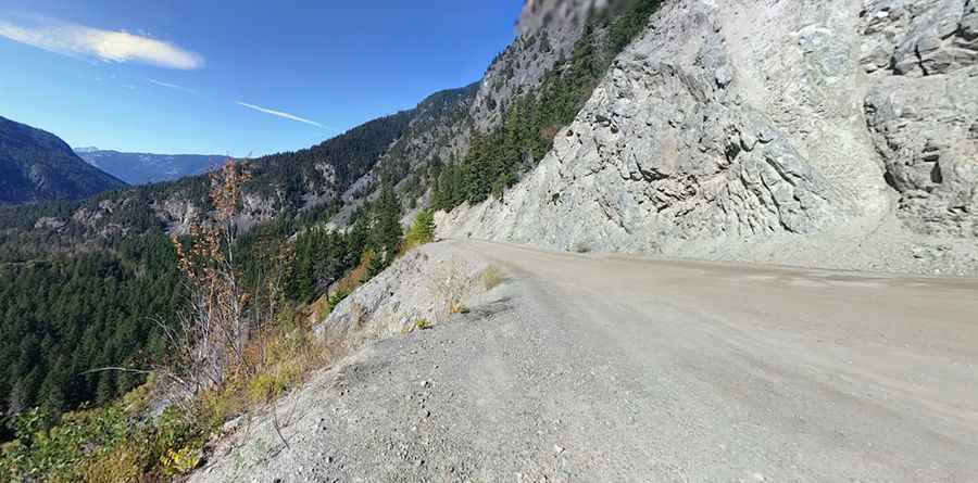
The drive can be nerve-wracking, featuring both paved and unpaved sections. It’s paved for the first 319 km to Anahim Lake. Then, it transitions to an all-season gravel road. The road is not for the faint of heart. Driving in low gears and fully concentrating on the road is necessary when navigating the hair-pinned killer curves. It's such a white-knuckle gravel road that, on occasion, tourists who have ventured down it have refused to return. The road accommodates all traffic year-round, including semi-trailer trucks and large recreational vehicles.
How challenging is the road to Bella Coola?
The road is very challenging, including 11 km of switchbacks on the way up to Heckman Pass, nicknamed as The Hill, at 1,524 m (5,000 ft) above sea level. The road descends 43 km (27 mi) of steep, narrow road with sharp hairpin turns and two major switchbacks to the Bella Coola Valley. The descent includes a 9 km (5.6 mi) section with grades of up to 18% (about 1 in 6). At this gradient, it’s said to be the steepest road in British Columbia. During steep sections, it’s best to put your vehicle in first gear and go slow. Remember, uphill traffic has the right-of-way. Some sections are single-lane. Tourists who have driven to Bella Coola from Williams Lake have been known to refuse to drive back and have had to be taken out by boat or floatplane.
Can you drive to Bella Coola?
Driving into Bella Coola is a spectacular experience. Due to its unique location and passing through remote areas, it is important when driving in these conditions to be prepared. There aren't many facilities along the way, so start out with a full tank of gas. You can easily make this trip in a day, especially in summer, but leave plenty of time to stop and explore.
When was the road to Bella Coola built?
The road was completed in 1953. With only two bulldozers starting from opposite ends, supplies bought on credit, and a labor force that only had the promise of being paid, they clawed their own way up and out of the valley. The work took one year and two weeks to complete. Today the road is officially known as Highway 20 but is still referred to locally as the "Freedom Road" to commemorate the earlier years of isolation.
Where was The Incredible Hulk filmed?
Forced to flee New York City after a battle against Abomination, leaving the United States to hide once again, Banner settled in a remote cabin in Bella Coola. The scene was actually filmed there, so the peaceful countryside you’re seeing is the real Bella Coola Valley in British Columbia. In this place, Banner managed to re-obtain the necklace Betty Ross was forced to pawn in order to reach New York. Taking advantage of the isolation of his new location for his new purpose regarding his transformations, Banner tried to learn how to control them.
Pic: George S