Driving the 4x4 Road to the Lookout at Greenstone Mountain in BC
Greenstone Mountain is a high peak at an elevation of 1,798m (5,898ft) above sea level, located in the Canadian province of British Columbia.
Where is Greenstone Mountain?
The peak is near Kamloops, in the southern part of the province, within the Thompson Valley.
What’s at the Summit of Greenstone Mountain?
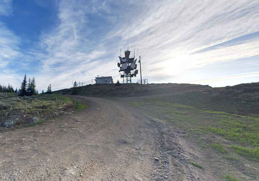
At the summit, you'll find several communication towers and the historic Greenstone Fire Lookout. Contrary to previous reports, the lookout is not abandoned. It was taken over three years ago by the Logan Lake ATV Club under a Memorandum of Understanding (MOU) with the 4WD Association of British Columbia (4WDABC). The club completed a $44,000 restoration project, including a new roof, scraping and painting, and the installation of stunning new triple-pane glass windows that provide amazing views. The site also features an outhouse and a picnic table, making it a welcoming spot for backcountry users.
Is the Road to Greenstone Mountain Unpaved?
The road to the summit, known as Greenstone Road, is entirely unpaved. Although most of the road is in decent shape, the final 300 meters are steep, rocky, and challenging for new or inexperienced off-roaders. You can drive the rough 4x4 road up to the communication towers, from where it’s a short hike to the true summit and the fire lookout.
How Long is the Road to Greenstone Mountain?
Starting from the paved Trans-Canada Highway, the road to the summit is 21.5 km (13.35 miles) long. Over this distance, the elevation gain is 1,202m, with an average gradient of 5.59%.
Is the Road to Greenstone Mountain Open in Winter?
Located within Greenstone Mountain Provincial Park, the road is typically inaccessible during winter and usually opens by the first week of June. Certain sections can become very muddy and slick in wet weather.
Road suggested by: Jane D Silva. President Logan Lake ATV Club
Pic: Sean Carney