How to drive the high-altitude mining road to Peak 09-48in British Columbia
Peak 09-48 is a high mountain summit at an elevation of 2,402 meters (7,880 ft) above sea level, located in the Regional District of East Kootenay, in the southeastern part of British Columbia, Canada. Reaching the peak involves driving one of the highest roads in the country.
| Road facts: Peak 09-48 | |
|---|---|
| Location | East Kootenay, British Columbia (Canada) |
| Elevation | 2,402 m (7,880 ft) |
| Length | ~15 km (9.3 miles) |
| Surface | Unpaved (Coarse industrial gravel) |
| Access | Private (Active mining operations) |
Where does the industrial road to Peak 09-48 start?
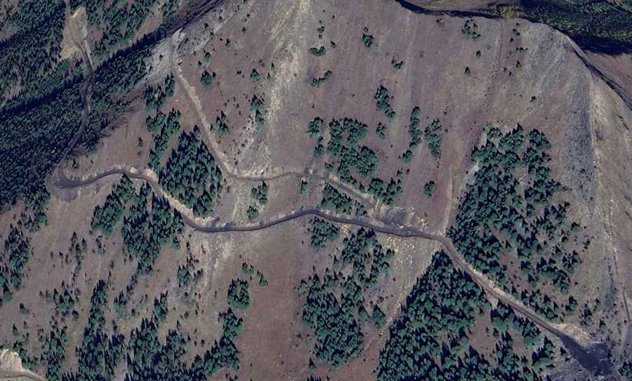
The 15-kilometer mountain track branches off the paved Fording River Road, also known as Fording Mine Road. The unpaved lane climbs steeply into the high-alpine ridges of the Rocky Mountains, serving as a heavy-machinery access route for the open-pit coal mining operations in the Fording River sector. The track features continuous hairpin turns and a rough base of coarse gravel and crushed dark rock.
What are the driving hazards and access limits on Peak 09-48?
The track is a private industrial road strictly closed to unauthorized public traffic due to the constant movement of massive mining haul trucks. The single-lane road lacks side guardrails or safety barriers above steep rock drop-offs. The primary driving hazards are the deep dust clouds raised by industrial vehicles that reduce visibility to zero, unstable dirt shoulders prone to collapsing under heavy weight, and sharp stone debris scattered by blasting operations that slice standard tires.
Is the road to Peak 09-48 open in winter?
At 2,402 meters above sea level, the mountain summit faces severe winter weather with heavy snow accumulation and ice. The track is only kept open for active industrial machinery using specialized plows, remaining completely impassable for standard vehicles. During the summer, sudden alpine snow squalls or heavy rainfall wash out sections of the unmaintained gravel trackbed, turning the steep ramps into slick mud tracks.