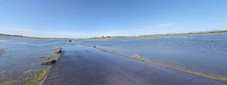
Shell Island Causeway is covered by sea water at high tide
Located in Gwynedd, Wales, Shell Island is a peninsula and the largest campsite in the UK. Twice a day, the tidal causeway to the island disappears with the tides, leaving the area underwater. The road is prone to tidal flooding. Do not proceed when the road is flooded. It’s one of the periodically flooded roads around the world.
Where is Shell Island Causeway?
Located on the northwestern part of the country, off the coast of North Wales, within Snowdonia National Park, west of Llanbedr, a fee is charged to cross the causeway. It lies across the estuary of the River Artro when the tide is out and is cut off by the tides twice a day. You really need to be careful with the timing; tide times vary from day to day. Check the official website for the best time to drive there. In the summer months, the area is massively popular.
Why is it called Shell Island?
The island itself is named after the variety of seashells that wash up on its shore.
Does Shell Island get cut off?
The peninsula (also known as Mochras) is linked by a tidal causeway which is covered by seawater at high tide, cutting off access to the island. The tide flows out through a series of drain pipes. Weather conditions may close the causeway.
Pic: Dragon Tv