How to Travel the A44: A Scenic Road from Rhayader to Aberystwyth
Part of the A44, one of the main roads in mid-Wales, the stretch from Rhayader to Aberystwyth is a highly scenic drive on the west coast of the country.
How long is the Road from Rhayader to Aberystwyth?
This 53.91-kilometer (33.5-mile) road runs west-east, connecting Aberystwyth, a coastal town on Cardigan Bay in the rugged Ceredigion coastline, with Rhayader, a market town in Powys. During World War II, the section of the road between Llangurig and Rhayader was renumbered to become part of the A470, which extends from Cardiff to Llandudno on the north coast.
Is the road from Rhayader to Aberystwyth challenging?
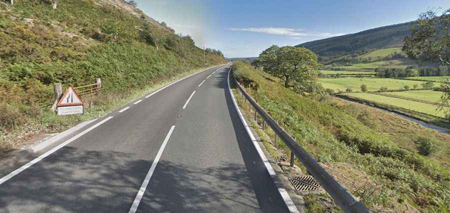
The road is fully paved and winds through the Cambrian Mountains, topping out at 435 meters (1,427 feet) above sea level. It is known for its curvy, narrow sections and breathtaking views, with plenty of stops along the way. Due to its winding nature, the road can be busy during weekends and holidays, as it serves as a key route through the mountains from the Midlands of England to South West Wales.
How risky is driving the road from Rhayader to Aberystwyth?
Accidents on this road are common because of its bendy nature, and some drivers may take it too fast. In 2014, it was noted as the fourth highest risk road in the UK. Rain is frequent, and clouds can cause thick fog, which can further complicate driving conditions. Despite the challenges, the drive is rewarding, offering spectacular views. The route runs for 34 miles, and it is advisable to allow at least 45 minutes to drive it without stops.